Volume VIII: Von Donop Inlet to Octopus Islands
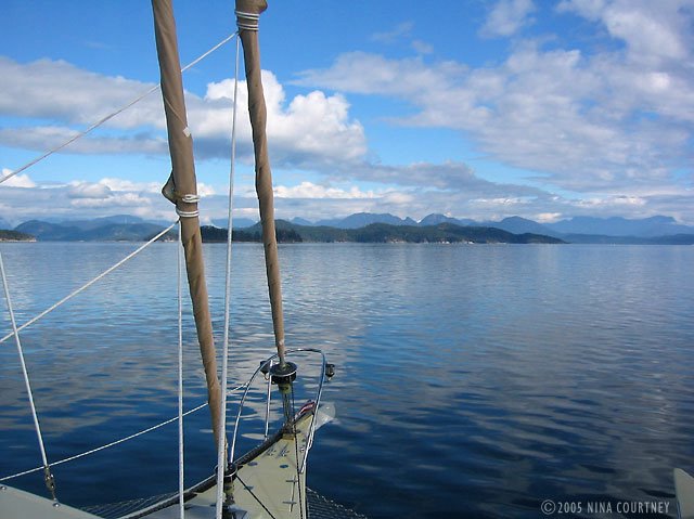
The day was sunny and the wind calm as we motored up to Lewis Channel to Teakerne Arm. A breeze began picking up from the south and we rolled out the jib. Almost there, we saw that Jim and Sharon were already on their way out, having had a lovely swim! They told us over VHF they were headed for Von Donop Inlet, the other side of Cortes Island, because a low was coming in. We'd planned to spend the night at Teakerne if the wind remained calm, but it was quickly rising. We snapped photos of the waterfall and made a quick tour of the shoreline as we listened to Environment Canada's weather forecast for strong southeasterlies headed our way. There is no anchorage at Cassel Lake– the shore drops off to 120 feet within mere yards of the rocks. We promised ourselves to visit again next year when there was no wind!
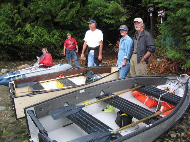
Von Donop seemed a good place to hide out from strong winds, so we joined Jim and Sharon there. Rikki-tikki's Northill anchor held us in place close to the southeast shore, hopefully protected from whatever was coming our way. We went to shore and hiked the left-hand trail which had a sign reading, "Squirrel Cove 2.5 km, Everywhere else 12 km." Walking for thirty minutes did not bring us to the point where we'd turned back from the other side. We were left wondering.
We invited Jim and Sharon to chicken dinner, which we poached "a la Danny Kaye", a recipe from Jacques Pépin's book, The Apprentice. It is gently boiled for only ten minutes, then rests in the poaching liquid for forty-five. A perfect energy-saving dish for cruisers! We enjoyed a wonderful evening– it was calm and windless, quiet and serene, save for our lively conversation around the table.
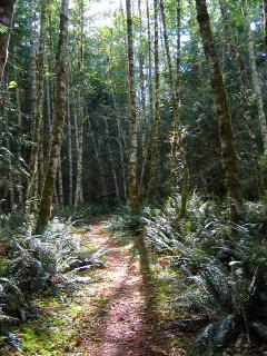
Next day, feeling the need to stretch our legs again, we set out on trail number three, the right-hand one, determined to actually arrive somewhere. It started out with a bit uphill, got my heart going, but then it leveled out to become a rolling path through alder and ferns. It was a pleasant and lovely trail, obviously well-travelled, but we were alone. Most of the trail is through First Nation People's land. Their name for Von Donop is Hathayim. The trail ended at the road to Whaletown, where we sat and had a snack, then hiked back. That afternoon, we heard the rumble of quadrunners and one appeared at the trailhead. Perhaps they were some of the volunteers who maintain the trails.
We finally saw another eagle! After spotting only two eagles at Rebecca Spit since we arrived in Canada August 4th, we've often asked ourselves, "Where are all the eagles?" Are there just too many people, too many boats, too much pressure on the environment? Wildlife seems sparse to us, the forest and skies silent. We did see a small flock of Bonaparte gulls here and two red-breasted sapsuckers while hiking.
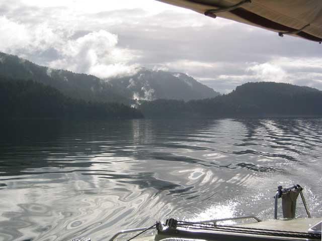
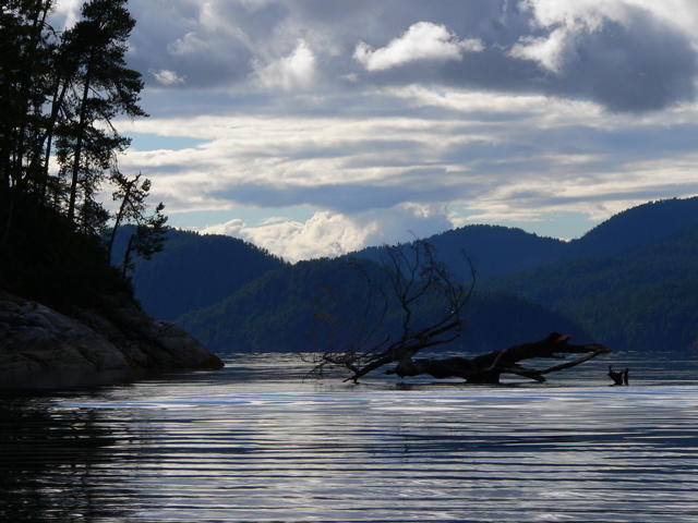
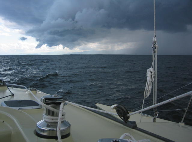
At nine a.m. before breakfast, we left for Hole-in-the-Wall, a passage with a rapids at the end. We needed to arrive at slack water and had decided at the last minute to leave... we hadn't even eaten breakfast! So we turned up the throttle and zoomed north at seven-plus knots. There was a lot of debris to dodge as the tide had been extremely high and, when that happens, a lot of stuff gets lifted off the shoreline and carried into the channels. Another gorgeous scene, a silvery reminder of the rain overnight, made my photo look like black and white!

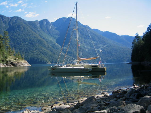
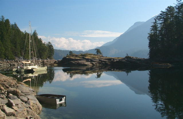
Our arrival at the rapids was either a couple of minutes too early or a couple too late. We steered through the mild, though unnerving, whirls and upwellings, crossing the channel to enter the Octopus Islands Marine Park at low tide. This can be a good thing because at least you can see where the rocks are! The channel is very narrow and we went dead slow. Two boats were already shore-tied and we did likewise across the cove.
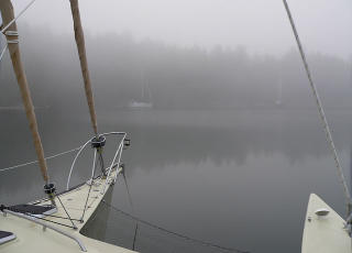
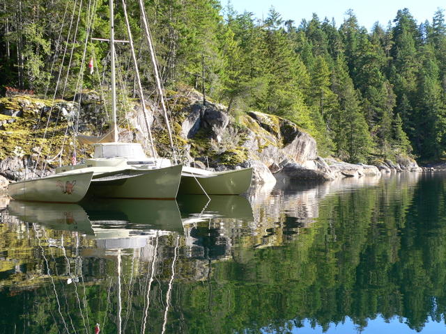
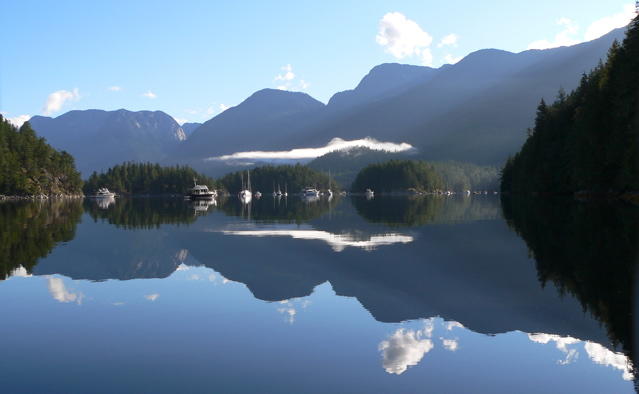
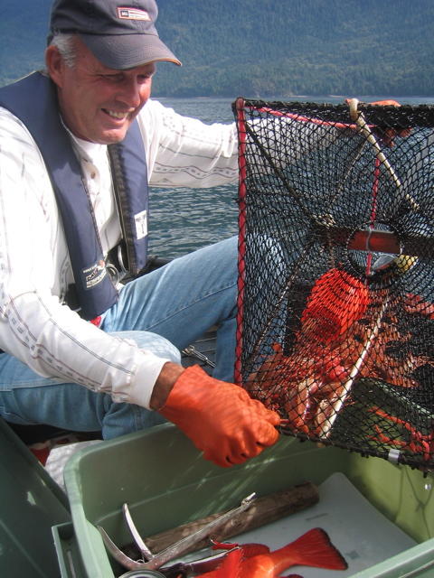
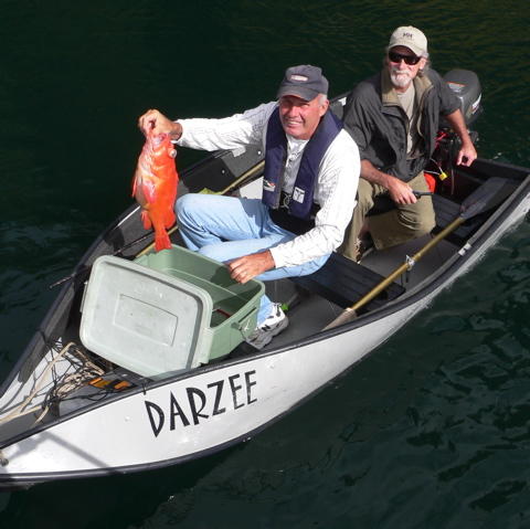
Octopus Islands are a cluster, a very small cluster, of rocky islets with lots more rocks and hard things to hit if you're not careful. We've been told that it's very crowded in summer so we were glad to be there in September! Only one other boat, a small houseboat on the last night, came into "our" cove the five nights we were there. We hiked (more about that later), worked on our blog, met the cruisers on the other two boats and explored in Darzee. It rained the first night and dawn came shrouded in fog, otherwise sun bathed Rikki-tikki.
Pat and Barry, who'd sailed their boat over from Hilo, Hawaii, told us that we had to go see a little cabin on the neighboring private island. We motored over in Darzee. It was chock-full with cruiser memorabilia! We spend an hour or so looking at mementos created and left by crews of boats. Some were very elaborate and large, others just a pencilled poem or decorated clamshell. It appeared to be a tradition for some to leave a new one or add to an existing artifact with each annual visit. We had to make and leave one from Rikki-tikki-tavi!

We selected a piece of driftwood from the shore in front of the cabin, took it back to RTT, and carved our contribution to the fantastic clutter. There is room for us to add the year of each future visit. We tied our creation to a beam above one of the windows.

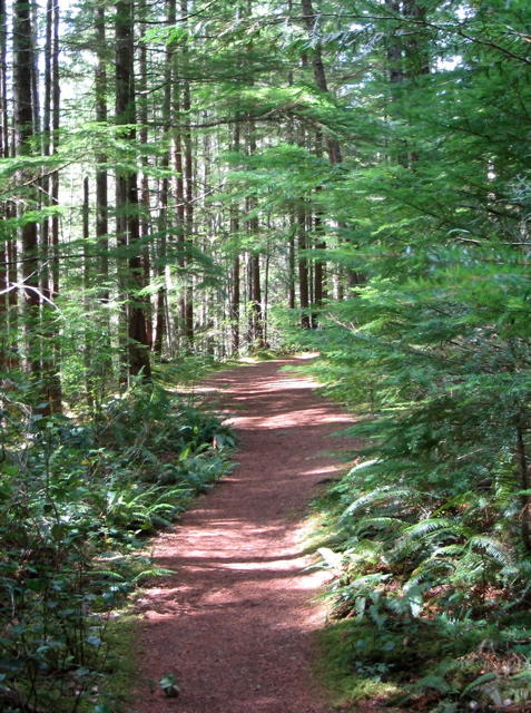
John and Lynda told us we should hike the trail to Newton Lake above Waiat Bay. They'd been for a swim four times since arriving. They told us to take the trail to the left and that it was the easier trail, forty-five minutes. They also said that there were wolves in the area (I knew I'd heard howling the previous night!). We motored over (it took ten minutes to get there at top speed!), tied Darzee up to the shore on a lowering tide, giving him a very long tether and pushing him out so he would float free and not have to be carried back to the water. With the motor, the weight would be unmanageable. A group of kayakers were arriving at the same time, but thought better of attempting the hike (did they know something we didn't?) and returned to their kayaks. So we set off into the dense forest, just the two of us. Everything was nice and fresh from the rain, ferns perky, mosses spongy and green. There was a plethora of fungi and we saw new ones we hadn't see before. We must get a book!
We took the left fork. As we went, the trail become more convoluted, detouring around downed trees and wet spots. It was obvious that someone maintains the trail as there were ribbon markers and freshly cut stumps, so it was not difficult to follow. In places, a deeply worn path cut through mosses three feet thick, dense sword ferns, cedar trees of some size but not old-growth. There were huge stumps with notches cut into them– evidence of logging long ago. We hiked for an hour. Clark started to question that we'd taken the right trail, but we'd seen no other and this one was clearly marked. So on we went. When the path turned uphill to become steep switchbacks, Clark was sure we'd done something wrong, but we kept climbing, very slowly. The path got narrower, suitable for mountain goats only– one edge went nearly straight down the mountain, the other side was steep enough to use as a handhold. I was worried about going back down!
Finally, we crossed a trickling falls and then heard a larger falls close by. We climbed some more, the path leveled out and we saw a swampy pond through the trees. No way! We hiked all this way for that? Just then, I stepped in some wolf poop. Thank goodness for the thick moss on the path sides– that is sticky stuff! This couldn't be the right lake, we decided, so we continued trudging along. We were rewarded by arriving (an hour and forty-five minutes later!) at Newton Lake– a sign confirmed it. Very large and with crystal clear water, the lake didn't seem to offer any shore with swimming access. Spotting a rock outcropping around to the left, we continued hiking there. At this point, Clark was still sure there was an easier trail than the one we'd suffered, but the path ended at the rocks. Snack time– all we brought was a little baggy of nuts!
We considered bathing but there was a chilly breeze and we hadn't brought a towel. We heard voices and I saw a couple on a rock outcrop to the right of where the trail came to the lake. It was Clark's turn to step in wolf poop on the way back. As he tried to remove the glop from his right shoe, he stepped into a whopper with his left shoe! Descending the steep trail, I stepped carefully over the ledges, rocks, tree roots, and banana slugs. I nailed one unfortunate invertebrate and almost slipped over the edge! We were soon overtaken by the two we'd seen at the lake. They bounded down the trail, with their dog in the lead, like mountain goats. John and Lynda arrived after us, got there while we were fumbling around on the wrong side of the lake, took their swim, and made it back to their dinghy way before us. Luckily they waited around on the shore for us to help carry Darzee. He'd gotten hung up in some rocks as the tide went out. All told, that hour and a half hike took us three and a half hours– and we didn't even get a swim! I saw a flotilla of surf scoters on the way back to Rikki.
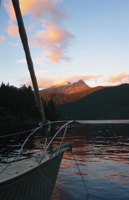
On the 24th, we left Octopus Islands headed for Surge Narrows at slack water, with a final destination of Rebecca Spit. It was another sunny, beautiful day in British Columbia!
Fair winds,
Clark and Nina
 we launched Darzee and
motored over to Heriot Bay for groceries and wireless internet down in
the Inn's laundry room while running a load. Another boat down from the
Octopus Islands was at the marina. He latter came to The Spit and
anchored real close to us (what else is new!?), but Clark warned him
that we had a lot of scope out so he pulled a line to a log ashore and
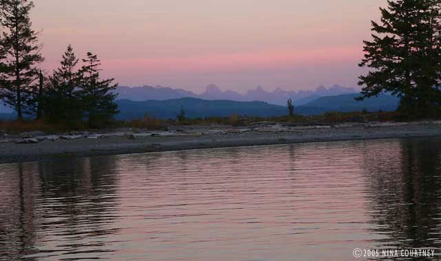
backed away. I managed to get a photo of the view before he arrived and
planted himself in the middle of it.
We spotted a little fleet of colorfully-painted Harlequin ducks, four
drakes with six in their harem. We'd never seen Harlequins before; we
strained our eyes admiring them. The drakes are stunning to look at and
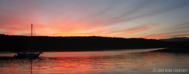
impossible to photograph– so shy. Another sailboat came in just as
evening arrived but he chose wisely and allowed plenty of swinging room
for both of us. His boat is the counterpoint to the gorgeous sky we all
enjoyed.
we launched Darzee and
motored over to Heriot Bay for groceries and wireless internet down in
the Inn's laundry room while running a load. Another boat down from the
Octopus Islands was at the marina. He latter came to The Spit and
anchored real close to us (what else is new!?), but Clark warned him
that we had a lot of scope out so he pulled a line to a log ashore and
backed away. I managed to get a photo of the view before he arrived and
planted himself in the middle of it.
We spotted a little fleet of colorfully-painted Harlequin ducks, four
drakes with six in their harem. We'd never seen Harlequins before; we
strained our eyes admiring them. The drakes are stunning to look at and
impossible to photograph– so shy. Another sailboat came in just as
evening arrived but he chose wisely and allowed plenty of swinging room
for both of us. His boat is the counterpoint to the gorgeous sky we all
enjoyed.
 Rikki-tikki-tavi made big arcs over the water as the tide came and
went, rocking a bit with the Whaletown ferry wake, but the wind
remained calm. Fall was in the air and the guests at the resort were
lounging in the sun overlooking the harbor. Kayakers paddled about and
campers walked their dogs along The Spit trail out to the tip. The
color of maple leaves turning vibrant hues accented the hillsides. It
was a relaxed atmosphere, no crowds of cruising boats from the US
bustling in and out of the marina, just the locals coming out to enjoy
the peace. In all, we made three trips to send and receive email,
download the latest version of GPSNavX, and do banking online. Thank
you, Heriot Bay!
Rikki-tikki-tavi made big arcs over the water as the tide came and
went, rocking a bit with the Whaletown ferry wake, but the wind
remained calm. Fall was in the air and the guests at the resort were
lounging in the sun overlooking the harbor. Kayakers paddled about and
campers walked their dogs along The Spit trail out to the tip. The
color of maple leaves turning vibrant hues accented the hillsides. It
was a relaxed atmosphere, no crowds of cruising boats from the US
bustling in and out of the marina, just the locals coming out to enjoy
the peace. In all, we made three trips to send and receive email,
download the latest version of GPSNavX, and do banking online. Thank
you, Heriot Bay!
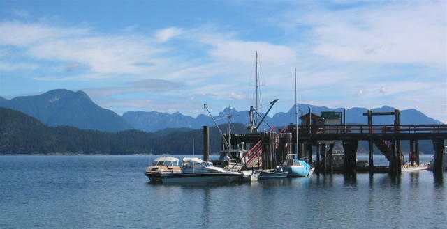
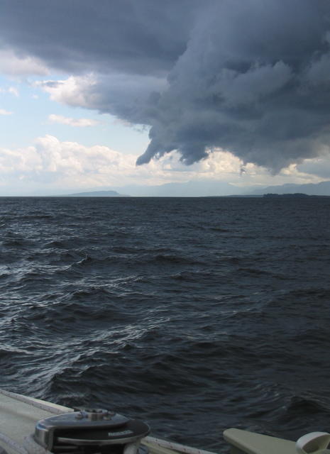
 A big low pressure system was predicted to bring strong SE winds, so we
took Rikki-tikki to Heriot Bay for fuel, once again squeezing him in
backwards between the ferry landing and the docks. Clark can maneuver
him into some very small spaces! The ferry comes in just beyond the
little floating store on the right in this photo.
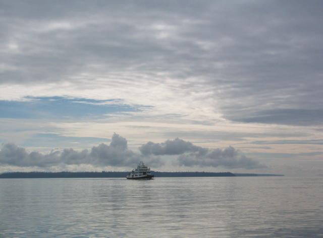
Gorge Harbour, on the south side of Cortes Island, beckoned with
promised protection from SE gales and we hadn't been there yet, so off
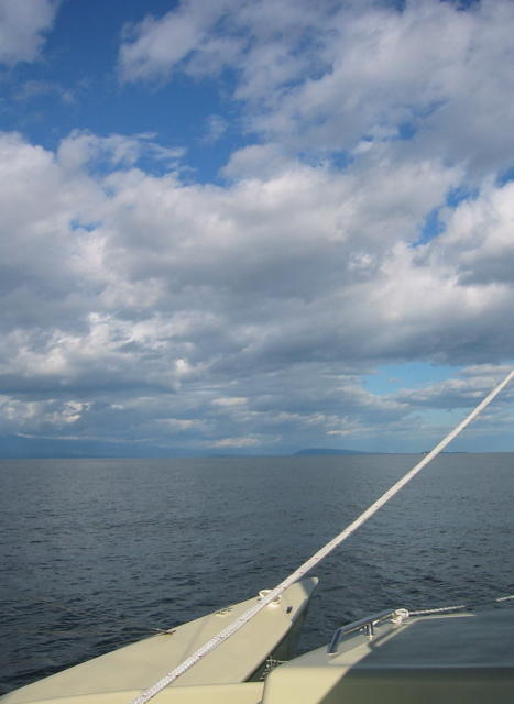
we went, motoring along under, yet again, amazing skies. It just
doesn't get boring! Each day's atmosphere and appearance is
surprisingly different from the one before. Even when it's silvery gray
or raining, the infinite variety of reflections, shapes and light give
us much pleasure.
A big low pressure system was predicted to bring strong SE winds, so we
took Rikki-tikki to Heriot Bay for fuel, once again squeezing him in
backwards between the ferry landing and the docks. Clark can maneuver
him into some very small spaces! The ferry comes in just beyond the
little floating store on the right in this photo.
Gorge Harbour, on the south side of Cortes Island, beckoned with
promised protection from SE gales and we hadn't been there yet, so off
we went, motoring along under, yet again, amazing skies. It just
doesn't get boring! Each day's atmosphere and appearance is
surprisingly different from the one before. Even when it's silvery gray
or raining, the infinite variety of reflections, shapes and light give
us much pleasure.
 I was hoping to see Shark Spit. We had to pass by it, through Z-shaped, tricky Uganda Passage, on the way to Gorge Harbour. I wanted to see if it was the place I remembered visiting while cruising with my grandparents as a teenager. The low-lying spit back then was so thick with live sand dollars of every size that there was little room for sand! It was impossible not to crunch them as one walked. We spent a sunny afternoon there, fascinated by the multiple layers of the spiny creatures, marveling in their purple billions. We lined up rows of graduated sizes, from the tiniest, smaller than ones baby finger, all the way to specimens a couple of inches across. Now I feared that they would be no more, but the time wasn't right to find out. The tide was very high and Shark Spit was hidden beneath the waves. I would have to wait for another visit, hopefully when a gale wasn't on its way.
 If we could buy an island, this would be the one. An islet next to
Shark Spit, it has just the right combination of rocky outcroppings and
protecting trees, a small bay for Rikki-tikki, and a great location for
a house with a dynamite view. There was already a house there of
course, with a guest cottage no less. Someone else owns Clark's Island.
Fair winds,
Clark & Nina
If we could buy an island, this would be the one. An islet next to
Shark Spit, it has just the right combination of rocky outcroppings and
protecting trees, a small bay for Rikki-tikki, and a great location for
a house with a dynamite view. There was already a house there of
course, with a guest cottage no less. Someone else owns Clark's Island.
Fair winds,
Clark & Nina


