Tuesday, November 15, 2005
Big Update Time
8 Volumes just got uploaded!
These updates were sent November 8th through the 15th... I just could not get them all up until now due to some technical problems and some minor health issues (take care of those teeth kids).
Use this post as a guide to help get you caught up on all the adventure.
Volume X
Volume XI
Volume XII
Volume XIII
Volume XIV
Volume XV
Volume XVI
Volume XVII
- ed (Mikey)
We Say Farewell
Volume XVII: We Say Farewell
We were truly enjoying the peaceful beauty of Wallace Island. We still
had the longer trail to its north tip to hike, but we needed to mail an
important letter. So we unhitched ourselves from Juniata and motored
out of Princess Cove. Dave and Marcia needed to position themselves for
a comfortable and safe crossing of Juan de Fuca Strait across the
border. They needed to exit Canada by the end of October. Fog and a
damp chill accompanied our boats for the trip down Trincomali– us to
Ganges on Saltspring Island, Juniata to Prevost Island. We decided to
rendezvous in Glenthorne Passage, on the northwest corner of Prevost,
after Rikki-tikki made a quick trip into town. The long trail would
have to wait for another visit. I enjoyed a mug of hot coffee as we
motored down the Channel.
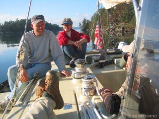
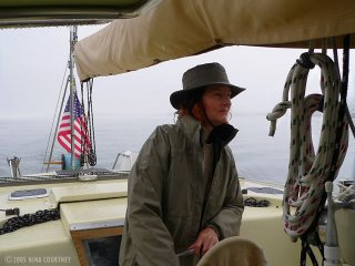
 Remember the photo of me with the rain gear on as we crossed Swartz
Bay? At Tod Inlet later that day, I got the bright idea to simply pull
out the bottom edges of the boom cover to create a mini rain cover.
It's amazing how just this little bit of extra canvas over the wheel
keeps the helmsperson from getting soaked. Why we didn't think if this
sooner, we have no clue– it was so obvious! We could've kept a lot
drier on our long days sitting in the rain as we came up the coast!
The sun broke through while we were at Ganges doing email, picking up
groceries, mailing letters. Juniata was anchored in Glenthorne waiting
for us. We invited them over for afternoon coffee out on deck where we
could lounge about soaking up the warmth. Marcia brought over some cold
beer. What a pleasant afternoon it turned out to be– sharing the last
days of summer/fall cruising in BC with such good friends. We knew it
was precious time. We are so very fortunate.
Remember the photo of me with the rain gear on as we crossed Swartz
Bay? At Tod Inlet later that day, I got the bright idea to simply pull
out the bottom edges of the boom cover to create a mini rain cover.
It's amazing how just this little bit of extra canvas over the wheel
keeps the helmsperson from getting soaked. Why we didn't think if this
sooner, we have no clue– it was so obvious! We could've kept a lot
drier on our long days sitting in the rain as we came up the coast!
The sun broke through while we were at Ganges doing email, picking up
groceries, mailing letters. Juniata was anchored in Glenthorne waiting
for us. We invited them over for afternoon coffee out on deck where we
could lounge about soaking up the warmth. Marcia brought over some cold
beer. What a pleasant afternoon it turned out to be– sharing the last
days of summer/fall cruising in BC with such good friends. We knew it
was precious time. We are so very fortunate.
 We looked out our portlights in the morning hoping for more sun. On an
expanse of gray silk floated hazy islands, their tops swathed in cloud.
The sun was up there somewhere but it looked like it would not be
allowed through for a good while. So Clark put a low-carb sour cream
coffee cake (Dana Carpender's recipe) into the oven, and I quietly
rowed over to see if Marcia and Dave were awake. They listened to the
VHF marine forecast and then joined us.
We spent the morning hours together, sharing ideas and plans for next
year's cruising, sipping coffee. Then it was time for them to leave.
Already? Hugs and best wishes, it's not like forever. Just be safe and
call us when you get across. It has been such great fun, a long-awaited
journey made and friends met. We'll see you soon out on the water!
We looked out our portlights in the morning hoping for more sun. On an
expanse of gray silk floated hazy islands, their tops swathed in cloud.
The sun was up there somewhere but it looked like it would not be
allowed through for a good while. So Clark put a low-carb sour cream
coffee cake (Dana Carpender's recipe) into the oven, and I quietly
rowed over to see if Marcia and Dave were awake. They listened to the
VHF marine forecast and then joined us.
We spent the morning hours together, sharing ideas and plans for next
year's cruising, sipping coffee. Then it was time for them to leave.
Already? Hugs and best wishes, it's not like forever. Just be safe and
call us when you get across. It has been such great fun, a long-awaited
journey made and friends met. We'll see you soon out on the water!
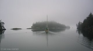 The only spot of color in a monochrome landscape, Juniata's Erin green
canvas fades into the mist as she motors away. Good friends, farewell.
A few days later, after we'd moved Rikki-tikki-tavi to his winter
grounds at Montague Harbour just a few miles away, we called Dave and
Marcia. They were snugly tucked into Juniata's winter home in Port
Ludlow, WA.
We are now getting settled on Galiano Island where we have been lent a
lovely home ashore. We can almost see the dock where Rikki-tikki is
moored. We'll be doing some installations aboard– a new high-output
alternator to keep the batteries topped up when there is no sun for the
solar panels, some more insulation for the chilly weather farther
north, and fixing two leaks. Rikki has performed so well, not much is
to be done.
We made a 1000-mile (we haven't even added it all up yet!) journey up
the West Coast with a boat we'd only sailed three times on San
Francisco Bay. With little time to practice and no ocean experience, we
all did a damned good job, especially Rikki-tikki-tavi. Clark, by no
small measure, is an admirable boat builder. He made it all possible.
Dave called it a "Bang up job!" As a captain, Clark possesses a calm
assurance. He has presence of mind, perseverance, creativity and
practicality, a pleasant demeanor and lots of patience. We'll go on
cruising together forever, he and I.
May the skies always be sunny in your hearts,
Nina
Clark & Nina
The only spot of color in a monochrome landscape, Juniata's Erin green
canvas fades into the mist as she motors away. Good friends, farewell.
A few days later, after we'd moved Rikki-tikki-tavi to his winter
grounds at Montague Harbour just a few miles away, we called Dave and
Marcia. They were snugly tucked into Juniata's winter home in Port
Ludlow, WA.
We are now getting settled on Galiano Island where we have been lent a
lovely home ashore. We can almost see the dock where Rikki-tikki is
moored. We'll be doing some installations aboard– a new high-output
alternator to keep the batteries topped up when there is no sun for the
solar panels, some more insulation for the chilly weather farther
north, and fixing two leaks. Rikki has performed so well, not much is
to be done.
We made a 1000-mile (we haven't even added it all up yet!) journey up
the West Coast with a boat we'd only sailed three times on San
Francisco Bay. With little time to practice and no ocean experience, we
all did a damned good job, especially Rikki-tikki-tavi. Clark, by no
small measure, is an admirable boat builder. He made it all possible.
Dave called it a "Bang up job!" As a captain, Clark possesses a calm
assurance. He has presence of mind, perseverance, creativity and
practicality, a pleasant demeanor and lots of patience. We'll go on
cruising together forever, he and I.
May the skies always be sunny in your hearts,
Nina
Clark & Nina
 Remember the photo of me with the rain gear on as we crossed Swartz
Bay? At Tod Inlet later that day, I got the bright idea to simply pull
out the bottom edges of the boom cover to create a mini rain cover.
It's amazing how just this little bit of extra canvas over the wheel
keeps the helmsperson from getting soaked. Why we didn't think if this
sooner, we have no clue– it was so obvious! We could've kept a lot
drier on our long days sitting in the rain as we came up the coast!
The sun broke through while we were at Ganges doing email, picking up
groceries, mailing letters. Juniata was anchored in Glenthorne waiting
for us. We invited them over for afternoon coffee out on deck where we
could lounge about soaking up the warmth. Marcia brought over some cold
beer. What a pleasant afternoon it turned out to be– sharing the last
days of summer/fall cruising in BC with such good friends. We knew it
was precious time. We are so very fortunate.
Remember the photo of me with the rain gear on as we crossed Swartz
Bay? At Tod Inlet later that day, I got the bright idea to simply pull
out the bottom edges of the boom cover to create a mini rain cover.
It's amazing how just this little bit of extra canvas over the wheel
keeps the helmsperson from getting soaked. Why we didn't think if this
sooner, we have no clue– it was so obvious! We could've kept a lot
drier on our long days sitting in the rain as we came up the coast!
The sun broke through while we were at Ganges doing email, picking up
groceries, mailing letters. Juniata was anchored in Glenthorne waiting
for us. We invited them over for afternoon coffee out on deck where we
could lounge about soaking up the warmth. Marcia brought over some cold
beer. What a pleasant afternoon it turned out to be– sharing the last
days of summer/fall cruising in BC with such good friends. We knew it
was precious time. We are so very fortunate.
 We looked out our portlights in the morning hoping for more sun. On an
expanse of gray silk floated hazy islands, their tops swathed in cloud.
The sun was up there somewhere but it looked like it would not be
allowed through for a good while. So Clark put a low-carb sour cream
coffee cake (Dana Carpender's recipe) into the oven, and I quietly
rowed over to see if Marcia and Dave were awake. They listened to the
VHF marine forecast and then joined us.
We spent the morning hours together, sharing ideas and plans for next
year's cruising, sipping coffee. Then it was time for them to leave.
Already? Hugs and best wishes, it's not like forever. Just be safe and
call us when you get across. It has been such great fun, a long-awaited
journey made and friends met. We'll see you soon out on the water!
We looked out our portlights in the morning hoping for more sun. On an
expanse of gray silk floated hazy islands, their tops swathed in cloud.
The sun was up there somewhere but it looked like it would not be
allowed through for a good while. So Clark put a low-carb sour cream
coffee cake (Dana Carpender's recipe) into the oven, and I quietly
rowed over to see if Marcia and Dave were awake. They listened to the
VHF marine forecast and then joined us.
We spent the morning hours together, sharing ideas and plans for next
year's cruising, sipping coffee. Then it was time for them to leave.
Already? Hugs and best wishes, it's not like forever. Just be safe and
call us when you get across. It has been such great fun, a long-awaited
journey made and friends met. We'll see you soon out on the water!
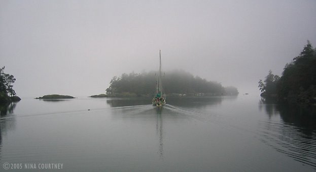 The only spot of color in a monochrome landscape, Juniata's Erin green
canvas fades into the mist as she motors away. Good friends, farewell.
A few days later, after we'd moved Rikki-tikki-tavi to his winter
grounds at Montague Harbour just a few miles away, we called Dave and
Marcia. They were snugly tucked into Juniata's winter home in Port
Ludlow, WA.
We are now getting settled on Galiano Island where we have been lent a
lovely home ashore. We can almost see the dock where Rikki-tikki is
moored. We'll be doing some installations aboard– a new high-output
alternator to keep the batteries topped up when there is no sun for the
solar panels, some more insulation for the chilly weather farther
north, and fixing two leaks. Rikki has performed so well, not much is
to be done.
We made a 1000-mile (we haven't even added it all up yet!) journey up
the West Coast with a boat we'd only sailed three times on San
Francisco Bay. With little time to practice and no ocean experience, we
all did a damned good job, especially Rikki-tikki-tavi. Clark, by no
small measure, is an admirable boat builder. He made it all possible.
Dave called it a "Bang up job!" As a captain, Clark possesses a calm
assurance. He has presence of mind, perseverance, creativity and
practicality, a pleasant demeanor and lots of patience. We'll go on
cruising together forever, he and I.
May the skies always be sunny in your hearts,
Nina
Clark & Nina
The only spot of color in a monochrome landscape, Juniata's Erin green
canvas fades into the mist as she motors away. Good friends, farewell.
A few days later, after we'd moved Rikki-tikki-tavi to his winter
grounds at Montague Harbour just a few miles away, we called Dave and
Marcia. They were snugly tucked into Juniata's winter home in Port
Ludlow, WA.
We are now getting settled on Galiano Island where we have been lent a
lovely home ashore. We can almost see the dock where Rikki-tikki is
moored. We'll be doing some installations aboard– a new high-output
alternator to keep the batteries topped up when there is no sun for the
solar panels, some more insulation for the chilly weather farther
north, and fixing two leaks. Rikki has performed so well, not much is
to be done.
We made a 1000-mile (we haven't even added it all up yet!) journey up
the West Coast with a boat we'd only sailed three times on San
Francisco Bay. With little time to practice and no ocean experience, we
all did a damned good job, especially Rikki-tikki-tavi. Clark, by no
small measure, is an admirable boat builder. He made it all possible.
Dave called it a "Bang up job!" As a captain, Clark possesses a calm
assurance. He has presence of mind, perseverance, creativity and
practicality, a pleasant demeanor and lots of patience. We'll go on
cruising together forever, he and I.
May the skies always be sunny in your hearts,
Nina
Clark & Nina
Wallace Island
Volume XVI: Wallace Island
We had poked Rikki's nose carefully around the shoals to peek into
Princess Cove when we passed Wallace Island back in August. Boats were
cheek-to-jowl along the shore, so we kept going, vowing to return when
the crowds had vacated. Following Juniata into the cove this late in
the season, we were greeted by only two other boats. Dave directed how
he wanted us to anchor and tie to Juniata's port side. I took the
opportunity to practice maneuvering Rikki in reverse. I'd only done it
once before in Smuggler Cove, did just fine too. Needless to say, I am
not good at it– yet. Clark and Dave were giving me instructions at the
same time. I told them both that it's best if I can be allowed to feel
how the prop pushes the boat without the noise in my ears, so be quiet
already! I managed to back close to Juniata, then Clark took over and I
handed lines to Marcia..
Clark had baked a low-carb zucchini nut bread while we were underway
from Russell Island. After we settled in at Princess Cove, Marcia
sautéed some of the Tod Inlet apples to go with the zucchini bread.
What a yummy topping that made, lots of butter and cinnamon! Toasty
aboard Juniata after dinner, Dave discussed fitting his boat with an
autopilot like Rikki's.
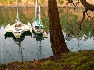 Here we are, snug as bugs in a rug at Princess Cove, Wallace Island.
Well, at least one bug... Rikki-tikki looks like a giant water skipper,
doesn't he?
Next morning, we rowed our twin dinghies to shore for a hike and a
haircut for Dave. Marcia put the electric clippers into service, deftly
trimming Dave's hair into shape under the canopy of an arbutus tree
while I watched rufous-sided towhees and winter wrens in the shrubs. We
also spotted an eagle sentinel on the rocks to the west of Conover Cove
and a great blue heron.
Here we are, snug as bugs in a rug at Princess Cove, Wallace Island.
Well, at least one bug... Rikki-tikki looks like a giant water skipper,
doesn't he?
Next morning, we rowed our twin dinghies to shore for a hike and a
haircut for Dave. Marcia put the electric clippers into service, deftly
trimming Dave's hair into shape under the canopy of an arbutus tree
while I watched rufous-sided towhees and winter wrens in the shrubs. We
also spotted an eagle sentinel on the rocks to the west of Conover Cove
and a great blue heron.
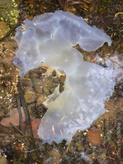
 We found these strange jelly things in the water. At first we thought
they were damaged pieces of jellyfish washed up to shore. But on closer
examination, we saw an attachment foot underneath each creature. Can
you identify these odd jellies? They are about a large hand-width
across, shaped rather like a wing, and with a tendon-like attachment to
the rocks.
We found these strange jelly things in the water. At first we thought
they were damaged pieces of jellyfish washed up to shore. But on closer
examination, we saw an attachment foot underneath each creature. Can
you identify these odd jellies? They are about a large hand-width
across, shaped rather like a wing, and with a tendon-like attachment to
the rocks.
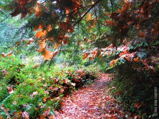
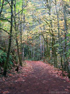
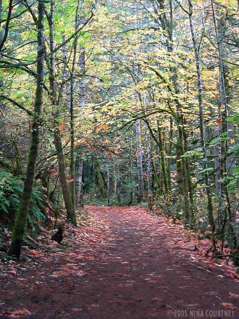
 The trails were wet with the recent rains and huge, orange maple leaves
draped themselves over everything like damp paper towels.
The trails were wet with the recent rains and huge, orange maple leaves
draped themselves over everything like damp paper towels.
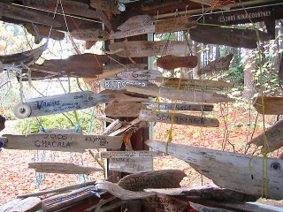
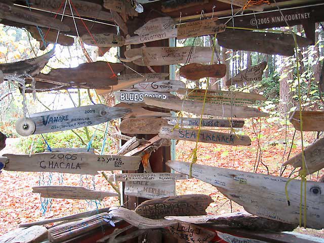
 Wallace Island also has a cruiser memorabilia cabin like the one we
found at the Octopus Islands. Hundreds of small driftwood signs,
emblazoned with the names of visiting boats, hang in profusion from the
ceiling. New arrivals attach their sign to ones already hanging,
creating gigantic mobiles inside the cabin.
Wallace Island also has a cruiser memorabilia cabin like the one we
found at the Octopus Islands. Hundreds of small driftwood signs,
emblazoned with the names of visiting boats, hang in profusion from the
ceiling. New arrivals attach their sign to ones already hanging,
creating gigantic mobiles inside the cabin.
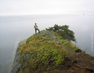
 At the far south tip of Wallace, Panther Point, Clark appears to have
reached the edge of the world, as the horizon blends away in the fog.
At the far south tip of Wallace, Panther Point, Clark appears to have
reached the edge of the world, as the horizon blends away in the fog.
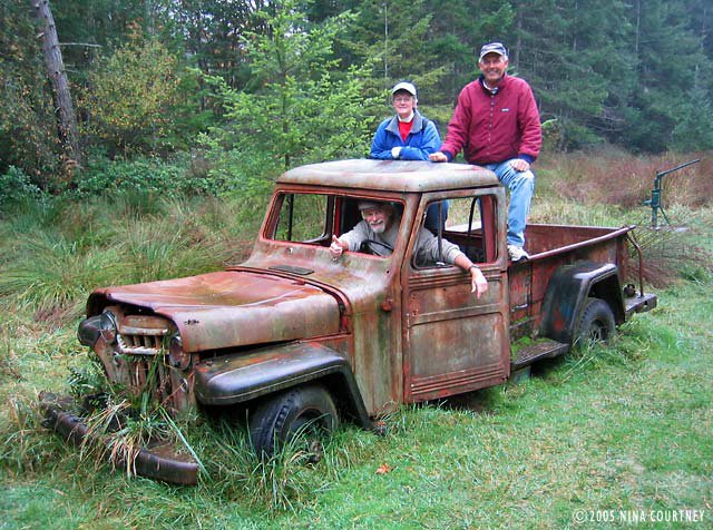
 There had been quite a successful small resort on the island for many
years before it became part of the BC Provincial Parks system. Some
cabins and relics are left for visitors to explore. There is a drive to
collect funds for restoration of some buildings. We are not the first
to pose in and around this old pickup truck! Clark's keen eye found a
Rubbermaid-housed geocache under the Jeep. Everything in the box was
soaked, so we drained it out and signed in on a waterlogged Post-It®
note with our geocaching "handle" and the date. Before we go set out
again in the spring, we'll log on to geocaching.com and make a list of
geocaches to seek! Geocaching can add another facet of adventure to our
already fascinating travels. Wouldn't it be fun to leave a Rikki Trail
of geocaches?
There had been quite a successful small resort on the island for many
years before it became part of the BC Provincial Parks system. Some
cabins and relics are left for visitors to explore. There is a drive to
collect funds for restoration of some buildings. We are not the first
to pose in and around this old pickup truck! Clark's keen eye found a
Rubbermaid-housed geocache under the Jeep. Everything in the box was
soaked, so we drained it out and signed in on a waterlogged Post-It®
note with our geocaching "handle" and the date. Before we go set out
again in the spring, we'll log on to geocaching.com and make a list of
geocaches to seek! Geocaching can add another facet of adventure to our
already fascinating travels. Wouldn't it be fun to leave a Rikki Trail
of geocaches?
 Anyway, here we are (except for me, the photographer) all smiles on
Wallace Island.
May the SE gales never blow your way,
Clark & Nina
Anyway, here we are (except for me, the photographer) all smiles on
Wallace Island.
May the SE gales never blow your way,
Clark & Nina
Here we are, snug as bugs in a rug at Princess Cove, Wallace Island.
Well, at least one bug... Rikki-tikki looks like a giant water skipper,
doesn't he?
Next morning, we rowed our twin dinghies to shore for a hike and a
haircut for Dave. Marcia put the electric clippers into service, deftly
trimming Dave's hair into shape under the canopy of an arbutus tree
while I watched rufous-sided towhees and winter wrens in the shrubs. We
also spotted an eagle sentinel on the rocks to the west of Conover Cove
and a great blue heron.
 We found these strange jelly things in the water. At first we thought
they were damaged pieces of jellyfish washed up to shore. But on closer
examination, we saw an attachment foot underneath each creature. Can
you identify these odd jellies? They are about a large hand-width
across, shaped rather like a wing, and with a tendon-like attachment to
the rocks.
We found these strange jelly things in the water. At first we thought
they were damaged pieces of jellyfish washed up to shore. But on closer
examination, we saw an attachment foot underneath each creature. Can
you identify these odd jellies? They are about a large hand-width
across, shaped rather like a wing, and with a tendon-like attachment to
the rocks.
 The trails were wet with the recent rains and huge, orange maple leaves
draped themselves over everything like damp paper towels.
The trails were wet with the recent rains and huge, orange maple leaves
draped themselves over everything like damp paper towels.
 Wallace Island also has a cruiser memorabilia cabin like the one we
found at the Octopus Islands. Hundreds of small driftwood signs,
emblazoned with the names of visiting boats, hang in profusion from the
ceiling. New arrivals attach their sign to ones already hanging,
creating gigantic mobiles inside the cabin.
Wallace Island also has a cruiser memorabilia cabin like the one we
found at the Octopus Islands. Hundreds of small driftwood signs,
emblazoned with the names of visiting boats, hang in profusion from the
ceiling. New arrivals attach their sign to ones already hanging,
creating gigantic mobiles inside the cabin.
 At the far south tip of Wallace, Panther Point, Clark appears to have
reached the edge of the world, as the horizon blends away in the fog.
At the far south tip of Wallace, Panther Point, Clark appears to have
reached the edge of the world, as the horizon blends away in the fog.
 There had been quite a successful small resort on the island for many
years before it became part of the BC Provincial Parks system. Some
cabins and relics are left for visitors to explore. There is a drive to
collect funds for restoration of some buildings. We are not the first
to pose in and around this old pickup truck! Clark's keen eye found a
Rubbermaid-housed geocache under the Jeep. Everything in the box was
soaked, so we drained it out and signed in on a waterlogged Post-It®
note with our geocaching "handle" and the date. Before we go set out
again in the spring, we'll log on to geocaching.com and make a list of
geocaches to seek! Geocaching can add another facet of adventure to our
already fascinating travels. Wouldn't it be fun to leave a Rikki Trail
of geocaches?
There had been quite a successful small resort on the island for many
years before it became part of the BC Provincial Parks system. Some
cabins and relics are left for visitors to explore. There is a drive to
collect funds for restoration of some buildings. We are not the first
to pose in and around this old pickup truck! Clark's keen eye found a
Rubbermaid-housed geocache under the Jeep. Everything in the box was
soaked, so we drained it out and signed in on a waterlogged Post-It®
note with our geocaching "handle" and the date. Before we go set out
again in the spring, we'll log on to geocaching.com and make a list of
geocaches to seek! Geocaching can add another facet of adventure to our
already fascinating travels. Wouldn't it be fun to leave a Rikki Trail
of geocaches?
 Anyway, here we are (except for me, the photographer) all smiles on
Wallace Island.
May the SE gales never blow your way,
Clark & Nina
Anyway, here we are (except for me, the photographer) all smiles on
Wallace Island.
May the SE gales never blow your way,
Clark & Nina
Finlayson Arm to Russell Island
Volume XV: Finlayson Arm to Russell Island
Wow! Blue sky! Now that the days are predominately gray, chilly and
damp (if not downright soaking wet), we sure appreciate the sun when
the clouds open up. Dave thought it would be fun to compare our
knotmeter readouts, so as we motored down Squally Reach, which wasn't
squally as you can see, he throttled up to six knots and we matched it
on our GPS. Our knotmeter is at least a knot slow. It needs cleaning
and calibrating, but we knew that. We both slowed to a more
fuel-efficient speed (diesel is over a dollar per liter here!), and
enjoyed a short trip down Finlayson Arm, deeper into Vancouver Island.
 This inlet leads to a salmon spawning river at Goldstream. We'd read in
the cruising guide that it was great fun to row a dinghy into the
stream to watch the salmon in shallow water as they came in to lay
eggs. Sea lions were cruising the Arm too, gulping down the large,
silvery fish. Flocks of gulls screeched and chased one another as they
picked up scraps.
Finlayson is deep, bereft of protected niches and so doesn't offer much
in the way of anchorages. One dinky dent in the mountainside is named
Misery Bay. You get the point– no hiding from squally winds there! The
area behind a small island (Sawluctus) near the head was listed in our
guide as the best spot to drop a hook. We went in and found some bottom
at about forty feet, most of it was about seventy. There were dozens of
big, opaque butter-yellow jellies with fringed edges and long,
threadlike tentacles. Marcia called them Lion's Mane jellyfish. Juniata
elected to anchor across from the small marina, so we put down the
Delta near them. Through the binocs, we could read a sign, "Environment
Protection Area: No Access." Clark rowed over to the marina to ask how
one would get to the Goldstream spawning area since dinghies weren't
allowed. "Hike up to the highway, then walk about a mile to the Visitor
Center," he was told. More hiking? We were pretty much hiked out after
Tod Inlet... Maybe we can visit by car someday.
Next day also dawned very placid and mild. We needed some supplies, so
Marcia called Gerta on her cellphone and Gerta said she could drive us
where we needed to go. Rikki-tikki could take the mooring at the Deep
Cove villa and she'd be waiting. We weighed anchor and headed north. I
went below for a quick shower and washed my hair. As we secured to the
buoy, Juniata passed by on the way to Russell Island Marine Park. This
photo is looking out from the villa across Satellite Channel, Saanich
Inlet, toward Sansum Narrows. With Gerta at the wheel, we made a good
day of it– collecting boat parts, groceries, and visitor info like
ferry and bus schedules. We treated her to lunch at the fabulous Fish
On Fifth in Sidney. Thanks, Gerta!
This inlet leads to a salmon spawning river at Goldstream. We'd read in
the cruising guide that it was great fun to row a dinghy into the
stream to watch the salmon in shallow water as they came in to lay
eggs. Sea lions were cruising the Arm too, gulping down the large,
silvery fish. Flocks of gulls screeched and chased one another as they
picked up scraps.
Finlayson is deep, bereft of protected niches and so doesn't offer much
in the way of anchorages. One dinky dent in the mountainside is named
Misery Bay. You get the point– no hiding from squally winds there! The
area behind a small island (Sawluctus) near the head was listed in our
guide as the best spot to drop a hook. We went in and found some bottom
at about forty feet, most of it was about seventy. There were dozens of
big, opaque butter-yellow jellies with fringed edges and long,
threadlike tentacles. Marcia called them Lion's Mane jellyfish. Juniata
elected to anchor across from the small marina, so we put down the
Delta near them. Through the binocs, we could read a sign, "Environment
Protection Area: No Access." Clark rowed over to the marina to ask how
one would get to the Goldstream spawning area since dinghies weren't
allowed. "Hike up to the highway, then walk about a mile to the Visitor
Center," he was told. More hiking? We were pretty much hiked out after
Tod Inlet... Maybe we can visit by car someday.
Next day also dawned very placid and mild. We needed some supplies, so
Marcia called Gerta on her cellphone and Gerta said she could drive us
where we needed to go. Rikki-tikki could take the mooring at the Deep
Cove villa and she'd be waiting. We weighed anchor and headed north. I
went below for a quick shower and washed my hair. As we secured to the
buoy, Juniata passed by on the way to Russell Island Marine Park. This
photo is looking out from the villa across Satellite Channel, Saanich
Inlet, toward Sansum Narrows. With Gerta at the wheel, we made a good
day of it– collecting boat parts, groceries, and visitor info like
ferry and bus schedules. We treated her to lunch at the fabulous Fish
On Fifth in Sidney. Thanks, Gerta!
 Dave and Marcia were waiting for us, tucked behind little Russell
Island, which is at the entrance to Fulford Harbor on Saltspring
Island. Russell Island was settled by immigrants from Hawai'i who were
brought here to work on the Canadian railway. As we anchored, a very
strange-looking catamaran came motoring toward us from the Saltspring
shore. Its hulls were bright yellow and lashed together with two spar
sections, an outboard mounted between. It was cold-molded construction
and of course we asked questions, as they did of us. Turns out this was
their first tryout in the water after the launch. Phillipe and Guy hope
to offer nature tours under oar power, though they will step a mast
once the akas and tramps are in place. We'd love to see the finished
boat. They invited us to stop at their place anytime for a visit. We
wish them well.
The four of us walked the short (and thankfully level) trail around the
island, examined the remnants of the settlements and watched the birds.
We decided to move on to Wallace Island, a Marine Park in Trincomali
Channel on the opposite side of Saltspring Island. When we pulled up
the Delta, this very large sunflower star was firmly gripped to the
stock and chain. It was tough to pry loose and left numerous sucker
feet behind. Sorry, we hope they grow back quickly!
Dave and Marcia were waiting for us, tucked behind little Russell
Island, which is at the entrance to Fulford Harbor on Saltspring
Island. Russell Island was settled by immigrants from Hawai'i who were
brought here to work on the Canadian railway. As we anchored, a very
strange-looking catamaran came motoring toward us from the Saltspring
shore. Its hulls were bright yellow and lashed together with two spar
sections, an outboard mounted between. It was cold-molded construction
and of course we asked questions, as they did of us. Turns out this was
their first tryout in the water after the launch. Phillipe and Guy hope
to offer nature tours under oar power, though they will step a mast
once the akas and tramps are in place. We'd love to see the finished
boat. They invited us to stop at their place anytime for a visit. We
wish them well.
The four of us walked the short (and thankfully level) trail around the
island, examined the remnants of the settlements and watched the birds.
We decided to move on to Wallace Island, a Marine Park in Trincomali
Channel on the opposite side of Saltspring Island. When we pulled up
the Delta, this very large sunflower star was firmly gripped to the
stock and chain. It was tough to pry loose and left numerous sucker
feet behind. Sorry, we hope they grow back quickly!
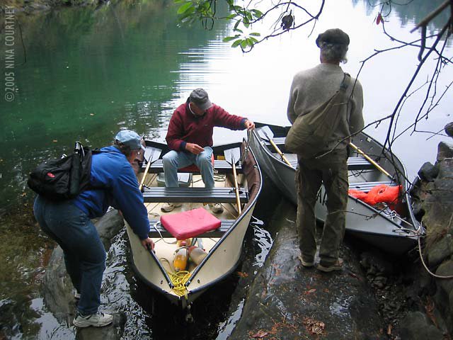
 At a relaxed pace, we followed Dave and Marcia to Princess Cove, mostly
under power. Clark baked a low-carb zucchini nut bread with
cranberries. A small breeze picked up in Trincomali and we rolled out
the jib for a bit. The late October sun felt good on our faces. Good
friends, good weather, great cruising!
May the sun brighten your days,
Clark & Nina
At a relaxed pace, we followed Dave and Marcia to Princess Cove, mostly
under power. Clark baked a low-carb zucchini nut bread with
cranberries. A small breeze picked up in Trincomali and we rolled out
the jib for a bit. The late October sun felt good on our faces. Good
friends, good weather, great cruising!
May the sun brighten your days,
Clark & Nina
 This inlet leads to a salmon spawning river at Goldstream. We'd read in
the cruising guide that it was great fun to row a dinghy into the
stream to watch the salmon in shallow water as they came in to lay
eggs. Sea lions were cruising the Arm too, gulping down the large,
silvery fish. Flocks of gulls screeched and chased one another as they
picked up scraps.
Finlayson is deep, bereft of protected niches and so doesn't offer much
in the way of anchorages. One dinky dent in the mountainside is named
Misery Bay. You get the point– no hiding from squally winds there! The
area behind a small island (Sawluctus) near the head was listed in our
guide as the best spot to drop a hook. We went in and found some bottom
at about forty feet, most of it was about seventy. There were dozens of
big, opaque butter-yellow jellies with fringed edges and long,
threadlike tentacles. Marcia called them Lion's Mane jellyfish. Juniata
elected to anchor across from the small marina, so we put down the
Delta near them. Through the binocs, we could read a sign, "Environment
Protection Area: No Access." Clark rowed over to the marina to ask how
one would get to the Goldstream spawning area since dinghies weren't
allowed. "Hike up to the highway, then walk about a mile to the Visitor
Center," he was told. More hiking? We were pretty much hiked out after
Tod Inlet... Maybe we can visit by car someday.
Next day also dawned very placid and mild. We needed some supplies, so
Marcia called Gerta on her cellphone and Gerta said she could drive us
where we needed to go. Rikki-tikki could take the mooring at the Deep
Cove villa and she'd be waiting. We weighed anchor and headed north. I
went below for a quick shower and washed my hair. As we secured to the
buoy, Juniata passed by on the way to Russell Island Marine Park. This
photo is looking out from the villa across Satellite Channel, Saanich
Inlet, toward Sansum Narrows. With Gerta at the wheel, we made a good
day of it– collecting boat parts, groceries, and visitor info like
ferry and bus schedules. We treated her to lunch at the fabulous Fish
On Fifth in Sidney. Thanks, Gerta!
This inlet leads to a salmon spawning river at Goldstream. We'd read in
the cruising guide that it was great fun to row a dinghy into the
stream to watch the salmon in shallow water as they came in to lay
eggs. Sea lions were cruising the Arm too, gulping down the large,
silvery fish. Flocks of gulls screeched and chased one another as they
picked up scraps.
Finlayson is deep, bereft of protected niches and so doesn't offer much
in the way of anchorages. One dinky dent in the mountainside is named
Misery Bay. You get the point– no hiding from squally winds there! The
area behind a small island (Sawluctus) near the head was listed in our
guide as the best spot to drop a hook. We went in and found some bottom
at about forty feet, most of it was about seventy. There were dozens of
big, opaque butter-yellow jellies with fringed edges and long,
threadlike tentacles. Marcia called them Lion's Mane jellyfish. Juniata
elected to anchor across from the small marina, so we put down the
Delta near them. Through the binocs, we could read a sign, "Environment
Protection Area: No Access." Clark rowed over to the marina to ask how
one would get to the Goldstream spawning area since dinghies weren't
allowed. "Hike up to the highway, then walk about a mile to the Visitor
Center," he was told. More hiking? We were pretty much hiked out after
Tod Inlet... Maybe we can visit by car someday.
Next day also dawned very placid and mild. We needed some supplies, so
Marcia called Gerta on her cellphone and Gerta said she could drive us
where we needed to go. Rikki-tikki could take the mooring at the Deep
Cove villa and she'd be waiting. We weighed anchor and headed north. I
went below for a quick shower and washed my hair. As we secured to the
buoy, Juniata passed by on the way to Russell Island Marine Park. This
photo is looking out from the villa across Satellite Channel, Saanich
Inlet, toward Sansum Narrows. With Gerta at the wheel, we made a good
day of it– collecting boat parts, groceries, and visitor info like
ferry and bus schedules. We treated her to lunch at the fabulous Fish
On Fifth in Sidney. Thanks, Gerta!
 Dave and Marcia were waiting for us, tucked behind little Russell
Island, which is at the entrance to Fulford Harbor on Saltspring
Island. Russell Island was settled by immigrants from Hawai'i who were
brought here to work on the Canadian railway. As we anchored, a very
strange-looking catamaran came motoring toward us from the Saltspring
shore. Its hulls were bright yellow and lashed together with two spar
sections, an outboard mounted between. It was cold-molded construction
and of course we asked questions, as they did of us. Turns out this was
their first tryout in the water after the launch. Phillipe and Guy hope
to offer nature tours under oar power, though they will step a mast
once the akas and tramps are in place. We'd love to see the finished
boat. They invited us to stop at their place anytime for a visit. We
wish them well.
The four of us walked the short (and thankfully level) trail around the
island, examined the remnants of the settlements and watched the birds.
We decided to move on to Wallace Island, a Marine Park in Trincomali
Channel on the opposite side of Saltspring Island. When we pulled up
the Delta, this very large sunflower star was firmly gripped to the
stock and chain. It was tough to pry loose and left numerous sucker
feet behind. Sorry, we hope they grow back quickly!
Dave and Marcia were waiting for us, tucked behind little Russell
Island, which is at the entrance to Fulford Harbor on Saltspring
Island. Russell Island was settled by immigrants from Hawai'i who were
brought here to work on the Canadian railway. As we anchored, a very
strange-looking catamaran came motoring toward us from the Saltspring
shore. Its hulls were bright yellow and lashed together with two spar
sections, an outboard mounted between. It was cold-molded construction
and of course we asked questions, as they did of us. Turns out this was
their first tryout in the water after the launch. Phillipe and Guy hope
to offer nature tours under oar power, though they will step a mast
once the akas and tramps are in place. We'd love to see the finished
boat. They invited us to stop at their place anytime for a visit. We
wish them well.
The four of us walked the short (and thankfully level) trail around the
island, examined the remnants of the settlements and watched the birds.
We decided to move on to Wallace Island, a Marine Park in Trincomali
Channel on the opposite side of Saltspring Island. When we pulled up
the Delta, this very large sunflower star was firmly gripped to the
stock and chain. It was tough to pry loose and left numerous sucker
feet behind. Sorry, we hope they grow back quickly!
 At a relaxed pace, we followed Dave and Marcia to Princess Cove, mostly
under power. Clark baked a low-carb zucchini nut bread with
cranberries. A small breeze picked up in Trincomali and we rolled out
the jib for a bit. The late October sun felt good on our faces. Good
friends, good weather, great cruising!
May the sun brighten your days,
Clark & Nina
At a relaxed pace, we followed Dave and Marcia to Princess Cove, mostly
under power. Clark baked a low-carb zucchini nut bread with
cranberries. A small breeze picked up in Trincomali and we rolled out
the jib for a bit. The late October sun felt good on our faces. Good
friends, good weather, great cruising!
May the sun brighten your days,
Clark & Nina
The Butchart Gardens
Volume XIV: The Butchart Gardens
From the dinghy dock in Tod Inlet, we walked the short trail to The
Butchart Gardens main entrance. After gulping hard at the fees
(thankfully somewhat lower this time of year) we spent hours walking
along the paths at the leisurely pace admiring the warm Fall colors,
myriad textures and stunning dahlias, in full bloom despite the cooler
temps. Even in the chill and damp, it was all serenely and
astonishingly beautiful. The grayness of the day didn't dull the colors
for the camera in the least. Workers were busy setting out thousands of
plants for the winter season. Holiday lighting displays begin December
1st.
 This is the main garden where the quarry pit used to be... You can
climb the stairs to the top of the vine-covered rock spire in the
center. Please stay on the paved path!
This is the main garden where the quarry pit used to be... You can
climb the stairs to the top of the vine-covered rock spire in the
center. Please stay on the paved path!
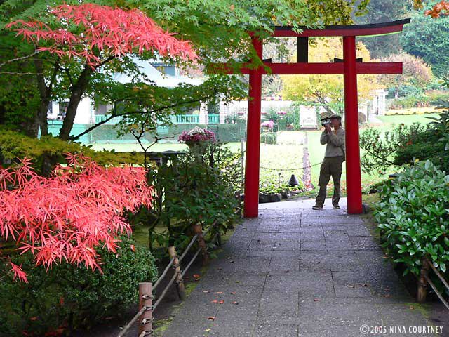
 Clark taking video at the entrance to the Japanese garden.
 An opening in the hedge has been cut to allow viewing into Butchart
Cove, which has a back gate through the Japanese Garden. When you
arrive and call them on the intercom, an employee comes to collect your
money and let you in. Boats crowd in here during the summer months.
It's empty this time of year. Tour buses still arrive at the main gate
with loads of tourists– we were lucky that crowds were light.
An opening in the hedge has been cut to allow viewing into Butchart
Cove, which has a back gate through the Japanese Garden. When you
arrive and call them on the intercom, an employee comes to collect your
money and let you in. Boats crowd in here during the summer months.
It's empty this time of year. Tour buses still arrive at the main gate
with loads of tourists– we were lucky that crowds were light.
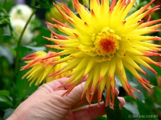 Just one of the varieties of spectacular dahlias at Butchart Gardens,
this spiky bloom is dripping with rain.
Just one of the varieties of spectacular dahlias at Butchart Gardens,
this spiky bloom is dripping with rain.
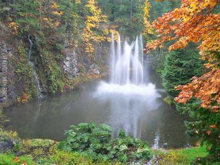 Fountains dance in the large pond, The Pit itself. They are lit at
night. There are also fireworks on Saturday nights during the summer
(just can imagine the crush of boats!). We bought passes good for a
year, so we'll be back.
Our legs walked out for awhile, late the next morning Juniata untied
the lines holding Rikki-tikki alongside, cranked up their chain and
anchor, and we both motored over the glassy waters of Finlayson Arm to
Goldstream. We were hoping to see spawning salmon!
Smooth seas,
Clark & Nina
Fountains dance in the large pond, The Pit itself. They are lit at
night. There are also fireworks on Saturday nights during the summer
(just can imagine the crush of boats!). We bought passes good for a
year, so we'll be back.
Our legs walked out for awhile, late the next morning Juniata untied
the lines holding Rikki-tikki alongside, cranked up their chain and
anchor, and we both motored over the glassy waters of Finlayson Arm to
Goldstream. We were hoping to see spawning salmon!
Smooth seas,
Clark & Nina
 This is the main garden where the quarry pit used to be... You can
climb the stairs to the top of the vine-covered rock spire in the
center. Please stay on the paved path!
This is the main garden where the quarry pit used to be... You can
climb the stairs to the top of the vine-covered rock spire in the
center. Please stay on the paved path!
 Clark taking video at the entrance to the Japanese garden.
 An opening in the hedge has been cut to allow viewing into Butchart
Cove, which has a back gate through the Japanese Garden. When you
arrive and call them on the intercom, an employee comes to collect your
money and let you in. Boats crowd in here during the summer months.
It's empty this time of year. Tour buses still arrive at the main gate
with loads of tourists– we were lucky that crowds were light.
An opening in the hedge has been cut to allow viewing into Butchart
Cove, which has a back gate through the Japanese Garden. When you
arrive and call them on the intercom, an employee comes to collect your
money and let you in. Boats crowd in here during the summer months.
It's empty this time of year. Tour buses still arrive at the main gate
with loads of tourists– we were lucky that crowds were light.
 Just one of the varieties of spectacular dahlias at Butchart Gardens,
this spiky bloom is dripping with rain.
Just one of the varieties of spectacular dahlias at Butchart Gardens,
this spiky bloom is dripping with rain.
 Fountains dance in the large pond, The Pit itself. They are lit at
night. There are also fireworks on Saturday nights during the summer
(just can imagine the crush of boats!). We bought passes good for a
year, so we'll be back.
Our legs walked out for awhile, late the next morning Juniata untied
the lines holding Rikki-tikki alongside, cranked up their chain and
anchor, and we both motored over the glassy waters of Finlayson Arm to
Goldstream. We were hoping to see spawning salmon!
Smooth seas,
Clark & Nina
Fountains dance in the large pond, The Pit itself. They are lit at
night. There are also fireworks on Saturday nights during the summer
(just can imagine the crush of boats!). We bought passes good for a
year, so we'll be back.
Our legs walked out for awhile, late the next morning Juniata untied
the lines holding Rikki-tikki alongside, cranked up their chain and
anchor, and we both motored over the glassy waters of Finlayson Arm to
Goldstream. We were hoping to see spawning salmon!
Smooth seas,
Clark & Nina
Tsehum Harbor to Tod Inlet
Volume XIII: Tsehum Harbor to Tod Inlet
On October 15th, Rikki-tikki-tavi and Juniata, each with his or her
respective crew aboard, joined once again at Tsehum Harbour on the
Saanich Peninsula of Vancouver Island. Rikki-tikki, I guess one could
say, closed the circle, crossing the track he created upon entering
Canada at Tsehum on August 4th. We were excitedly looking forward to
some one-on-one time with Dave and Marcia, visiting and sharing
experiences, before they had to leave Canada and we would tie Rikki to
the dock in Montague Harbour. The weather was pleasant and partly
sunny. We filled up the diesel tank and the water tanks at Van Isle
Marina shortly before Juniata came in from Victoria to anchor nearby.
We loaded two-plus months' worth of accumulated garbage into Darzee and
took it to the marina compactor for proper disposal. Most of the
islands do not have garbage disposal (at least not for free) so we
consolidated our trash as we cruised and stored it in an ama. We
recycled our glass and cans. That done, we visited with Dave and Marcia
in Juniata's cockpit, soaking up the sun. As hunger pangs struck, we
moved over to Rikki-tikki for a "dinner" of cheeses and smoked
shellfish.
It was threatening rain as Juniata went into the yacht club dock next
morning. We motored over in Darzee that afternoon. Gerta arrived in her
BMW to take us for a special dinner at a lovely shoreside villa on Deep
Cove where she was housesitting. Everyone headed immediately for the
big kitchen where Clark fell in love– with the stove. He was in seventh
heaven, in ecstasy, cooking on an Aga. If that Aga didn't weigh nearly
as much as Rikki-tikki himself, I'm sure Clark would figure out how to
get one aboard! He was having so much fun– roasting, baking, sautéing.
He even had time to throw together a beautiful tray of appetizers. I
found a piano in the living room and plunked out a few classical
pieces. Luckily for those listeners in the kitchen, the music scores
available for me to sight-read were simple. It could've been ugly
otherwise. I hadn't touched the keys in decades. I even enjoyed the
music myself!
Returning to Rikki just at dark, we started up our diesel heater to
warm the boat but sleep was hard to come by. The wind and waves bumped
and jostled us all night. It rained buckets. Gusts of wind shook loose
glops of water from the rigging, which plummeted to the deck above our
heads in unpredictable thumps. Our brains seem able to tune out steady
rain, but not this random pelting. Each time we started to drift into
dreamland, the noise would startle us awake. The wind calmed by morning
but the day started out chilly, foggy and drizzly.
The first time we were at Tsehum, we saw a crab boat pulling lines of
traps out from under the dozens of anchored boats. We didn't see any
floats marking the cables, each with several metal mesh traps attached.
In the US each trap must have a float. In Canada, a crabber is required
only one at each end of the cable connecting up to ten traps. When we
told people that crabtraps were on all over the bottom of Tsehum
harbor, nobody believed us. Well, the crab boat was out again! He
pulled at least four lines of traps, harvesting crabs, and resetting
traps under the anchorage. We wondered how many boats tangle their
anchor in a trap or snag a cable. There are a lot of traps down there!
 When the crab boat was pulling a line of traps next to Rikki-tikki, I
took several photos. Here's oneÐ taken through our aft settee window.
There is an undersized crab teetering on the gunwale.
Late morning, Rikki followed Juniata out of Tsehum, zigzagged through
John Passage between Coal and Goudge Islands, down Colburne Passage,
and across the very heavily trafficked Swartz Bay BC Ferries Terminals.
The fog was pretty thick so we had turned on the radar. Clark watched
the screen for approaching ferries as I steered Rikki-tikki at a brisk
pace. There are lanes converging from three different directions! Just
as we cleared the last terminal, a big Tsawwassen ferry loomed out of
the fog from Gosse Passage to cross behind us. It slowly turned a 180û
to place the car deck stern toward the terminal. Whew!
When the crab boat was pulling a line of traps next to Rikki-tikki, I
took several photos. Here's oneÐ taken through our aft settee window.
There is an undersized crab teetering on the gunwale.
Late morning, Rikki followed Juniata out of Tsehum, zigzagged through
John Passage between Coal and Goudge Islands, down Colburne Passage,
and across the very heavily trafficked Swartz Bay BC Ferries Terminals.
The fog was pretty thick so we had turned on the radar. Clark watched
the screen for approaching ferries as I steered Rikki-tikki at a brisk
pace. There are lanes converging from three different directions! Just
as we cleared the last terminal, a big Tsawwassen ferry loomed out of
the fog from Gosse Passage to cross behind us. It slowly turned a 180û
to place the car deck stern toward the terminal. Whew!
 We arrived in Tod Inlet about one-thirty and side-tied with Juniata,
the only boats save a large trawler liveaboard that was here in August
too. It was good to get out and walk the trails. We scrounged a few
late blackberries and filled our pockets with apples, knocked out of
the trees in an abandoned orchard. We discovered a lovely fern-lined
canyon with tress upholstered in moss. Hikers had placed found items
along the retaining wall– leather soles from old shoes, broken
crockery, rusty iron farms tools, bottles and odd bits from the little
factory-town settlement that was here when the quarry was active. The
quarry, of course, became the famous Butchart Gardens, which is easily
visited from Tod Inlet, either by dinghy from Butchart Cove at the
entrance to Tod Inlet or by short trail from the head of Tod Inlet.
We arrived in Tod Inlet about one-thirty and side-tied with Juniata,
the only boats save a large trawler liveaboard that was here in August
too. It was good to get out and walk the trails. We scrounged a few
late blackberries and filled our pockets with apples, knocked out of
the trees in an abandoned orchard. We discovered a lovely fern-lined
canyon with tress upholstered in moss. Hikers had placed found items
along the retaining wall– leather soles from old shoes, broken
crockery, rusty iron farms tools, bottles and odd bits from the little
factory-town settlement that was here when the quarry was active. The
quarry, of course, became the famous Butchart Gardens, which is easily
visited from Tod Inlet, either by dinghy from Butchart Cove at the
entrance to Tod Inlet or by short trail from the head of Tod Inlet.
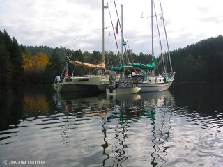 Juniata and Rikki-tikki-tavi anchored together in Tod Inlet– makes
visiting boat-to-boat very easy.
Juniata and Rikki-tikki-tavi anchored together in Tod Inlet– makes
visiting boat-to-boat very easy.
 The wide, maple leaf strewn path through the BC Park around Tod Inlet
is used by locals for biking, walking the dog, and running. The
residents are fortunate to have such a beautiful area just blocks away
from their homes. We cruisers are likewise grateful for the easy access
to stretch our legs and even catch a bus, if we want, to downtown
Victoria! Needing a few provisions, we asked if there was a grocery
within walking distance. An enthusiastic, helpful, friendly young man
gave us directions, said it was an easy 25-minute route. Trudging along
the road to Brentwood for twice that long, we finally found the store.
Stretching our legs is one thing, but walking nearly two hours
roundtrip for a few groceries is a bit much! I mean, do we really need
coffee that badly? If another enthusiastic, helpful, friendly YOUNG
person estimated walking time, we vowed to double it, then decide if we
were up to it! Dave, Marcia, Clark and I gratefully lowered ourselves
and our groceries into our dinghies and rowed out to our little
floating homes, where we could just sit. And sit.
Such is life aboard a boat!
May all trails and roads be level,
Clark & Nina
The wide, maple leaf strewn path through the BC Park around Tod Inlet
is used by locals for biking, walking the dog, and running. The
residents are fortunate to have such a beautiful area just blocks away
from their homes. We cruisers are likewise grateful for the easy access
to stretch our legs and even catch a bus, if we want, to downtown
Victoria! Needing a few provisions, we asked if there was a grocery
within walking distance. An enthusiastic, helpful, friendly young man
gave us directions, said it was an easy 25-minute route. Trudging along
the road to Brentwood for twice that long, we finally found the store.
Stretching our legs is one thing, but walking nearly two hours
roundtrip for a few groceries is a bit much! I mean, do we really need
coffee that badly? If another enthusiastic, helpful, friendly YOUNG
person estimated walking time, we vowed to double it, then decide if we
were up to it! Dave, Marcia, Clark and I gratefully lowered ourselves
and our groceries into our dinghies and rowed out to our little
floating homes, where we could just sit. And sit.
Such is life aboard a boat!
May all trails and roads be level,
Clark & Nina
 When the crab boat was pulling a line of traps next to Rikki-tikki, I
took several photos. Here's oneÐ taken through our aft settee window.
There is an undersized crab teetering on the gunwale.
Late morning, Rikki followed Juniata out of Tsehum, zigzagged through
John Passage between Coal and Goudge Islands, down Colburne Passage,
and across the very heavily trafficked Swartz Bay BC Ferries Terminals.
The fog was pretty thick so we had turned on the radar. Clark watched
the screen for approaching ferries as I steered Rikki-tikki at a brisk
pace. There are lanes converging from three different directions! Just
as we cleared the last terminal, a big Tsawwassen ferry loomed out of
the fog from Gosse Passage to cross behind us. It slowly turned a 180û
to place the car deck stern toward the terminal. Whew!
When the crab boat was pulling a line of traps next to Rikki-tikki, I
took several photos. Here's oneÐ taken through our aft settee window.
There is an undersized crab teetering on the gunwale.
Late morning, Rikki followed Juniata out of Tsehum, zigzagged through
John Passage between Coal and Goudge Islands, down Colburne Passage,
and across the very heavily trafficked Swartz Bay BC Ferries Terminals.
The fog was pretty thick so we had turned on the radar. Clark watched
the screen for approaching ferries as I steered Rikki-tikki at a brisk
pace. There are lanes converging from three different directions! Just
as we cleared the last terminal, a big Tsawwassen ferry loomed out of
the fog from Gosse Passage to cross behind us. It slowly turned a 180û
to place the car deck stern toward the terminal. Whew!

 We arrived in Tod Inlet about one-thirty and side-tied with Juniata,
the only boats save a large trawler liveaboard that was here in August
too. It was good to get out and walk the trails. We scrounged a few
late blackberries and filled our pockets with apples, knocked out of
the trees in an abandoned orchard. We discovered a lovely fern-lined
canyon with tress upholstered in moss. Hikers had placed found items
along the retaining wall– leather soles from old shoes, broken
crockery, rusty iron farms tools, bottles and odd bits from the little
factory-town settlement that was here when the quarry was active. The
quarry, of course, became the famous Butchart Gardens, which is easily
visited from Tod Inlet, either by dinghy from Butchart Cove at the
entrance to Tod Inlet or by short trail from the head of Tod Inlet.
We arrived in Tod Inlet about one-thirty and side-tied with Juniata,
the only boats save a large trawler liveaboard that was here in August
too. It was good to get out and walk the trails. We scrounged a few
late blackberries and filled our pockets with apples, knocked out of
the trees in an abandoned orchard. We discovered a lovely fern-lined
canyon with tress upholstered in moss. Hikers had placed found items
along the retaining wall– leather soles from old shoes, broken
crockery, rusty iron farms tools, bottles and odd bits from the little
factory-town settlement that was here when the quarry was active. The
quarry, of course, became the famous Butchart Gardens, which is easily
visited from Tod Inlet, either by dinghy from Butchart Cove at the
entrance to Tod Inlet or by short trail from the head of Tod Inlet.
 Juniata and Rikki-tikki-tavi anchored together in Tod Inlet– makes
visiting boat-to-boat very easy.
Juniata and Rikki-tikki-tavi anchored together in Tod Inlet– makes
visiting boat-to-boat very easy.
 The wide, maple leaf strewn path through the BC Park around Tod Inlet
is used by locals for biking, walking the dog, and running. The
residents are fortunate to have such a beautiful area just blocks away
from their homes. We cruisers are likewise grateful for the easy access
to stretch our legs and even catch a bus, if we want, to downtown
Victoria! Needing a few provisions, we asked if there was a grocery
within walking distance. An enthusiastic, helpful, friendly young man
gave us directions, said it was an easy 25-minute route. Trudging along
the road to Brentwood for twice that long, we finally found the store.
Stretching our legs is one thing, but walking nearly two hours
roundtrip for a few groceries is a bit much! I mean, do we really need
coffee that badly? If another enthusiastic, helpful, friendly YOUNG
person estimated walking time, we vowed to double it, then decide if we
were up to it! Dave, Marcia, Clark and I gratefully lowered ourselves
and our groceries into our dinghies and rowed out to our little
floating homes, where we could just sit. And sit.
Such is life aboard a boat!
May all trails and roads be level,
Clark & Nina
The wide, maple leaf strewn path through the BC Park around Tod Inlet
is used by locals for biking, walking the dog, and running. The
residents are fortunate to have such a beautiful area just blocks away
from their homes. We cruisers are likewise grateful for the easy access
to stretch our legs and even catch a bus, if we want, to downtown
Victoria! Needing a few provisions, we asked if there was a grocery
within walking distance. An enthusiastic, helpful, friendly young man
gave us directions, said it was an easy 25-minute route. Trudging along
the road to Brentwood for twice that long, we finally found the store.
Stretching our legs is one thing, but walking nearly two hours
roundtrip for a few groceries is a bit much! I mean, do we really need
coffee that badly? If another enthusiastic, helpful, friendly YOUNG
person estimated walking time, we vowed to double it, then decide if we
were up to it! Dave, Marcia, Clark and I gratefully lowered ourselves
and our groceries into our dinghies and rowed out to our little
floating homes, where we could just sit. And sit.
Such is life aboard a boat!
May all trails and roads be level,
Clark & Nina
Silva Bay & Pirates Cove
Volume XII: Silva Bay & Pirates Cove
This hitchhiking vamp at the end of the fuel dock sets Page's apart
from the other marinas in Silva Bay. Inside the little office and
bookstore are more whimsical sculptures and crafts from local artists.
A homey, friendly spot, where Ted & Phyllis will assist in finding the
perfect cruising guide or book of poetry for your reading pleasure.
They told us that the store down the way featured homemade sausages and
European cheeses, so we made fast tracks there under oar power. It's a
very small grocery but packed with a very wide selection of meats,
cheeses and those sausages, even salmon sausages! We brought our bootie
back to Rikki-tikki and tried some for dinner. The Stilton cheese with
apricot was very good as dessert.
 As I slid into the settee next morning with my coffee, I heard
crunching noises outside under the window where Darzee was tied. Two
otters were in the dinghy, munching loudly on fish. I reached for my
camera. Otters are pure perpetual motiion... they leaped out of the
dinghy just as I raised the camera of course. We've had otters in the
dinghy before – twice at Rebecca Spit – but always night visits by
unseen, messy otters. The scraps from their snacks had already
attracted hordes of flies by morning. Those otters required cleaning up
after. The otter family of four at Silva Bay were thankfully fastidious
and left no evidence of their meals.
We asked about internet access at Page's and were directed to the
restaurant/pub above the Silva Bay Marina. No luck. The young man in
the marina office offered to let us plug into the office ethernet, so
we brought our iBook over next day and did email while he was on the
docks attending to visiting sailboats. An unusual number for this time
of year seemed to be arriving. We later learned that this was three-day
Thanksgiving weekend in Canada. Even with the rain and windy
conditions, it seemed to us that a group of Sceptre 41s had made the
trip across the Strait of Georgia from Vancouver for a rendezvous. This
is only our assumption based on the fact that they were one-design and
all tied up together.
It's funny... we'd never heard of the Sceptre 41 until we got to the
Octopus Islands. John and Lynda's boat was of this Canadian design,
although he bought it as a hull and deck, finishing the interior and
outfitting himself. What a beauty! Perfect in every detail, with fine
craftsmanship and thoughtful layout, their Sceptre 41 looked like it
had just come, brand new, from a boat show. We were astonished to learn
that they had cruised BC aboard for eight seasons! After seeing their
lovely boat, we realized that another boat we'd seen several times at
different anchorages was also a Sceptre 41. John told us there were
only fifty made, so it was surprising to see four others arrive in
Silva Bay. Of the fifty, we've already seen six.
As we returned to Rikki-tikki, we saw that all four otters were on the
stern deck, running up and down our convenient transom steps with their
slimy catch. We crossed our fingers that we'd secured the aft window,
which we usually leave vented and hanging open because it's rainproof.
We had chicken thawing on the counter... what a mess they would be
making inside! Their neatness in the dinghy wouldn't prevail inside
Rikki, if they got in. Before I could get good photos, they were off in
a streak of shiny brown wetness. Thankfully, the window was cinched
down and we vowed never to leave Rikki with it open in otter country.
We left after breakfast next day to reach Gabriola Passage at high
slack. As we approached the pass, we saw a large power boat sitting
sideways across the channel. He moved aside as we neared, but suddenly
throttled up to cross our bow. As he went by, we noticed a very small
dive flag and a diver in a drysuit standing aft. Looking around, we
spotted the bubbles of at least one diver submerged near shore. We were
surprised that the dive boat didn't stay between vessel traffic (us)
and its divers. He should have. We remembered seeing a brochure in the
marina office that offered dive tours in Gabriola Passage. Diving is
only possible at slack current, but we didn't immediately connect the
sideways boat with diving until we saw the diver on board. Their dive
flag was way too small to be seen from any distance.
Pirates Cove, a small BC Marine Park, on De Courcy Island, was a place
we'd visited back in August 1993, during a heatwave. Back then we were
aboard a 32-foot catamaran captained by Roy Mills, and accompanied by
our friends, Bob and Peggy. Bob is the crewperson who so skillfully
steered Rikki-tikki through the maelstrom of our first night out from
San Francisco, May 26th. This October 2005 visit, the weather was very
much cooler and wetter, but the small bay was certainly a whole lot
less crowded!
As I slid into the settee next morning with my coffee, I heard
crunching noises outside under the window where Darzee was tied. Two
otters were in the dinghy, munching loudly on fish. I reached for my
camera. Otters are pure perpetual motiion... they leaped out of the
dinghy just as I raised the camera of course. We've had otters in the
dinghy before – twice at Rebecca Spit – but always night visits by
unseen, messy otters. The scraps from their snacks had already
attracted hordes of flies by morning. Those otters required cleaning up
after. The otter family of four at Silva Bay were thankfully fastidious
and left no evidence of their meals.
We asked about internet access at Page's and were directed to the
restaurant/pub above the Silva Bay Marina. No luck. The young man in
the marina office offered to let us plug into the office ethernet, so
we brought our iBook over next day and did email while he was on the
docks attending to visiting sailboats. An unusual number for this time
of year seemed to be arriving. We later learned that this was three-day
Thanksgiving weekend in Canada. Even with the rain and windy
conditions, it seemed to us that a group of Sceptre 41s had made the
trip across the Strait of Georgia from Vancouver for a rendezvous. This
is only our assumption based on the fact that they were one-design and
all tied up together.
It's funny... we'd never heard of the Sceptre 41 until we got to the
Octopus Islands. John and Lynda's boat was of this Canadian design,
although he bought it as a hull and deck, finishing the interior and
outfitting himself. What a beauty! Perfect in every detail, with fine
craftsmanship and thoughtful layout, their Sceptre 41 looked like it
had just come, brand new, from a boat show. We were astonished to learn
that they had cruised BC aboard for eight seasons! After seeing their
lovely boat, we realized that another boat we'd seen several times at
different anchorages was also a Sceptre 41. John told us there were
only fifty made, so it was surprising to see four others arrive in
Silva Bay. Of the fifty, we've already seen six.
As we returned to Rikki-tikki, we saw that all four otters were on the
stern deck, running up and down our convenient transom steps with their
slimy catch. We crossed our fingers that we'd secured the aft window,
which we usually leave vented and hanging open because it's rainproof.
We had chicken thawing on the counter... what a mess they would be
making inside! Their neatness in the dinghy wouldn't prevail inside
Rikki, if they got in. Before I could get good photos, they were off in
a streak of shiny brown wetness. Thankfully, the window was cinched
down and we vowed never to leave Rikki with it open in otter country.
We left after breakfast next day to reach Gabriola Passage at high
slack. As we approached the pass, we saw a large power boat sitting
sideways across the channel. He moved aside as we neared, but suddenly
throttled up to cross our bow. As he went by, we noticed a very small
dive flag and a diver in a drysuit standing aft. Looking around, we
spotted the bubbles of at least one diver submerged near shore. We were
surprised that the dive boat didn't stay between vessel traffic (us)
and its divers. He should have. We remembered seeing a brochure in the
marina office that offered dive tours in Gabriola Passage. Diving is
only possible at slack current, but we didn't immediately connect the
sideways boat with diving until we saw the diver on board. Their dive
flag was way too small to be seen from any distance.
Pirates Cove, a small BC Marine Park, on De Courcy Island, was a place
we'd visited back in August 1993, during a heatwave. Back then we were
aboard a 32-foot catamaran captained by Roy Mills, and accompanied by
our friends, Bob and Peggy. Bob is the crewperson who so skillfully
steered Rikki-tikki through the maelstrom of our first night out from
San Francisco, May 26th. This October 2005 visit, the weather was very
much cooler and wetter, but the small bay was certainly a whole lot
less crowded!
 We walked all the park trails, rowed Darzee around the small bay, and
got to know Luis and Betty on their self-built steel Dutch-design
sailboat. A group of young kayakers was camping in tents on the point,
apparently unfazed by the rain.
As we sat in the cockpit drinking our afternoon coffee, a very nice,
large sailboat of about 55' approached the entrance range-marker.
Pirates Cove has a tricky channel with shoals either side. Cruising
guides give clear instructions, the charts show the proper channel, and
there are red and green markers. The sailboat was on course for
avoiding the long shoal extending out from the point, but instead of
turning sharply to port to enter the channel between the markers, the
skipper brought the boat close in to shore and proceeded to drive right
over the rocks! I stood up, my heart in my throat for them, and
expected to hear fiberglass crunching on rock any second. Luckily for
them, it was a very high tide and the boat didn't ground. I told Clark
we should dinghy over when they got anchored to advise them of their
mistake, so they wouldn't risk damaging their bottom on the way out.
We didn't get the chance! They made a quick U-turn around an anchored
boat from Australia and headed back out the way they came! "NO!" I
yelled. They looked toward us. "Keep the red buoy to port on your way
out!" I called, as loudly as I could to be heard over their engine. All
aboard smiled and waved, then continued over the rocks, even closer to
shore than before! Yikes! We were just about to turn on the VHF and
hail them before it was too late, when a little sport boat zoomed out
from the resident docks blowing their horn and yelling, "Keep the red
buoy to port!" They raced over to the sailboat, repeating the warning.
The sailboat continued to inch forward. What were they thinking? Surely
they were aware of their shallow depth sounder readings. Finally, the
little motor boat reached the side of the sailboat. The sailors finally
turned to pay attention to the repeated warning, asking "Keep the red
buoy to port?" The little boat turned around, waited for the big
sailboat to back away from the shoal, then showed them the proper way
out. We were left shaking our heads. If the tide hadn't been extremely
high... Even the float planes use the marked channel.
At least it wasn't raining when we left Pirates Cove and motored down
Trincomali Channel toward Montague Harbour on Galiano Island. A brisk
south wind was blowing on our nose, and the water was lumpy. We'd
arranged for Rikki-tikki to have dock space at Montague, November
through January. The harbormaster was waiting for us to sign documents
and pay the modest moorage fee. We anchored out in the bay, rowed to
the dock and left a voicemail from the pay phone. As we returned to
Rikki, the sun came out and a rainbow appeared over the marina and
harbor. Perhaps a good omen?
We walked all the park trails, rowed Darzee around the small bay, and
got to know Luis and Betty on their self-built steel Dutch-design
sailboat. A group of young kayakers was camping in tents on the point,
apparently unfazed by the rain.
As we sat in the cockpit drinking our afternoon coffee, a very nice,
large sailboat of about 55' approached the entrance range-marker.
Pirates Cove has a tricky channel with shoals either side. Cruising
guides give clear instructions, the charts show the proper channel, and
there are red and green markers. The sailboat was on course for
avoiding the long shoal extending out from the point, but instead of
turning sharply to port to enter the channel between the markers, the
skipper brought the boat close in to shore and proceeded to drive right
over the rocks! I stood up, my heart in my throat for them, and
expected to hear fiberglass crunching on rock any second. Luckily for
them, it was a very high tide and the boat didn't ground. I told Clark
we should dinghy over when they got anchored to advise them of their
mistake, so they wouldn't risk damaging their bottom on the way out.
We didn't get the chance! They made a quick U-turn around an anchored
boat from Australia and headed back out the way they came! "NO!" I
yelled. They looked toward us. "Keep the red buoy to port on your way
out!" I called, as loudly as I could to be heard over their engine. All
aboard smiled and waved, then continued over the rocks, even closer to
shore than before! Yikes! We were just about to turn on the VHF and
hail them before it was too late, when a little sport boat zoomed out
from the resident docks blowing their horn and yelling, "Keep the red
buoy to port!" They raced over to the sailboat, repeating the warning.
The sailboat continued to inch forward. What were they thinking? Surely
they were aware of their shallow depth sounder readings. Finally, the
little motor boat reached the side of the sailboat. The sailors finally
turned to pay attention to the repeated warning, asking "Keep the red
buoy to port?" The little boat turned around, waited for the big
sailboat to back away from the shoal, then showed them the proper way
out. We were left shaking our heads. If the tide hadn't been extremely
high... Even the float planes use the marked channel.
At least it wasn't raining when we left Pirates Cove and motored down
Trincomali Channel toward Montague Harbour on Galiano Island. A brisk
south wind was blowing on our nose, and the water was lumpy. We'd
arranged for Rikki-tikki to have dock space at Montague, November
through January. The harbormaster was waiting for us to sign documents
and pay the modest moorage fee. We anchored out in the bay, rowed to
the dock and left a voicemail from the pay phone. As we returned to
Rikki, the sun came out and a rainbow appeared over the marina and
harbor. Perhaps a good omen?
 Turning away from the rainbow to face the setting sun, we saw that this
apparition of a shark had formed inside a cloud. Should we be worried?
Turning away from the rainbow to face the setting sun, we saw that this
apparition of a shark had formed inside a cloud. Should we be worried?
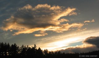 Fortuitously, a comfortable place ashore has been made available on
Galiano. My aunt offered her lovely house for our use while Rikki is
tied to the dock. Its deck overlooks the BC Marine Park beach. It's a
bit of a hike up the road to the property, but we plan on having our
car brought up to BC. We'll be able to get some larger sewing projects
done indoors, while also doing some small home repair for auntie.
Having a carpenter in the house for a few months was one of the perks
for her. The biggest advantage is ours though, and we send our
heartfelt gratitude. We are looking forward to being on Galiano Island
and getting to know BC a bit better by car.
Another low was forecast to bring SE gales, so we took Rikki to Ganges
for groceries, doing email at the Saltspring public library. Then we
took refuge in the small inlet called Glenthorne Passage on Prevost
Island, just across the way. We'd be meeting up with Dave and Marcia on
Juniata in a few days.
Fair winds,
Clark & Nina
Fortuitously, a comfortable place ashore has been made available on
Galiano. My aunt offered her lovely house for our use while Rikki is
tied to the dock. Its deck overlooks the BC Marine Park beach. It's a
bit of a hike up the road to the property, but we plan on having our
car brought up to BC. We'll be able to get some larger sewing projects
done indoors, while also doing some small home repair for auntie.
Having a carpenter in the house for a few months was one of the perks
for her. The biggest advantage is ours though, and we send our
heartfelt gratitude. We are looking forward to being on Galiano Island
and getting to know BC a bit better by car.
Another low was forecast to bring SE gales, so we took Rikki to Ganges
for groceries, doing email at the Saltspring public library. Then we
took refuge in the small inlet called Glenthorne Passage on Prevost
Island, just across the way. We'd be meeting up with Dave and Marcia on
Juniata in a few days.
Fair winds,
Clark & Nina
 As I slid into the settee next morning with my coffee, I heard
crunching noises outside under the window where Darzee was tied. Two
otters were in the dinghy, munching loudly on fish. I reached for my
camera. Otters are pure perpetual motiion... they leaped out of the
dinghy just as I raised the camera of course. We've had otters in the
dinghy before – twice at Rebecca Spit – but always night visits by
unseen, messy otters. The scraps from their snacks had already
attracted hordes of flies by morning. Those otters required cleaning up
after. The otter family of four at Silva Bay were thankfully fastidious
and left no evidence of their meals.
We asked about internet access at Page's and were directed to the
restaurant/pub above the Silva Bay Marina. No luck. The young man in
the marina office offered to let us plug into the office ethernet, so
we brought our iBook over next day and did email while he was on the
docks attending to visiting sailboats. An unusual number for this time
of year seemed to be arriving. We later learned that this was three-day
Thanksgiving weekend in Canada. Even with the rain and windy
conditions, it seemed to us that a group of Sceptre 41s had made the
trip across the Strait of Georgia from Vancouver for a rendezvous. This
is only our assumption based on the fact that they were one-design and
all tied up together.
It's funny... we'd never heard of the Sceptre 41 until we got to the
Octopus Islands. John and Lynda's boat was of this Canadian design,
although he bought it as a hull and deck, finishing the interior and
outfitting himself. What a beauty! Perfect in every detail, with fine
craftsmanship and thoughtful layout, their Sceptre 41 looked like it
had just come, brand new, from a boat show. We were astonished to learn
that they had cruised BC aboard for eight seasons! After seeing their
lovely boat, we realized that another boat we'd seen several times at
different anchorages was also a Sceptre 41. John told us there were
only fifty made, so it was surprising to see four others arrive in
Silva Bay. Of the fifty, we've already seen six.
As we returned to Rikki-tikki, we saw that all four otters were on the
stern deck, running up and down our convenient transom steps with their
slimy catch. We crossed our fingers that we'd secured the aft window,
which we usually leave vented and hanging open because it's rainproof.
We had chicken thawing on the counter... what a mess they would be
making inside! Their neatness in the dinghy wouldn't prevail inside
Rikki, if they got in. Before I could get good photos, they were off in
a streak of shiny brown wetness. Thankfully, the window was cinched
down and we vowed never to leave Rikki with it open in otter country.
We left after breakfast next day to reach Gabriola Passage at high
slack. As we approached the pass, we saw a large power boat sitting
sideways across the channel. He moved aside as we neared, but suddenly
throttled up to cross our bow. As he went by, we noticed a very small
dive flag and a diver in a drysuit standing aft. Looking around, we
spotted the bubbles of at least one diver submerged near shore. We were
surprised that the dive boat didn't stay between vessel traffic (us)
and its divers. He should have. We remembered seeing a brochure in the
marina office that offered dive tours in Gabriola Passage. Diving is
only possible at slack current, but we didn't immediately connect the
sideways boat with diving until we saw the diver on board. Their dive
flag was way too small to be seen from any distance.
Pirates Cove, a small BC Marine Park, on De Courcy Island, was a place
we'd visited back in August 1993, during a heatwave. Back then we were
aboard a 32-foot catamaran captained by Roy Mills, and accompanied by
our friends, Bob and Peggy. Bob is the crewperson who so skillfully
steered Rikki-tikki through the maelstrom of our first night out from
San Francisco, May 26th. This October 2005 visit, the weather was very
much cooler and wetter, but the small bay was certainly a whole lot
less crowded!
As I slid into the settee next morning with my coffee, I heard
crunching noises outside under the window where Darzee was tied. Two
otters were in the dinghy, munching loudly on fish. I reached for my
camera. Otters are pure perpetual motiion... they leaped out of the
dinghy just as I raised the camera of course. We've had otters in the
dinghy before – twice at Rebecca Spit – but always night visits by
unseen, messy otters. The scraps from their snacks had already
attracted hordes of flies by morning. Those otters required cleaning up
after. The otter family of four at Silva Bay were thankfully fastidious
and left no evidence of their meals.
We asked about internet access at Page's and were directed to the
restaurant/pub above the Silva Bay Marina. No luck. The young man in
the marina office offered to let us plug into the office ethernet, so
we brought our iBook over next day and did email while he was on the
docks attending to visiting sailboats. An unusual number for this time
of year seemed to be arriving. We later learned that this was three-day
Thanksgiving weekend in Canada. Even with the rain and windy
conditions, it seemed to us that a group of Sceptre 41s had made the
trip across the Strait of Georgia from Vancouver for a rendezvous. This
is only our assumption based on the fact that they were one-design and
all tied up together.
It's funny... we'd never heard of the Sceptre 41 until we got to the
Octopus Islands. John and Lynda's boat was of this Canadian design,
although he bought it as a hull and deck, finishing the interior and
outfitting himself. What a beauty! Perfect in every detail, with fine
craftsmanship and thoughtful layout, their Sceptre 41 looked like it
had just come, brand new, from a boat show. We were astonished to learn
that they had cruised BC aboard for eight seasons! After seeing their
lovely boat, we realized that another boat we'd seen several times at
different anchorages was also a Sceptre 41. John told us there were
only fifty made, so it was surprising to see four others arrive in
Silva Bay. Of the fifty, we've already seen six.
As we returned to Rikki-tikki, we saw that all four otters were on the
stern deck, running up and down our convenient transom steps with their
slimy catch. We crossed our fingers that we'd secured the aft window,
which we usually leave vented and hanging open because it's rainproof.
We had chicken thawing on the counter... what a mess they would be
making inside! Their neatness in the dinghy wouldn't prevail inside
Rikki, if they got in. Before I could get good photos, they were off in
a streak of shiny brown wetness. Thankfully, the window was cinched
down and we vowed never to leave Rikki with it open in otter country.
We left after breakfast next day to reach Gabriola Passage at high
slack. As we approached the pass, we saw a large power boat sitting
sideways across the channel. He moved aside as we neared, but suddenly
throttled up to cross our bow. As he went by, we noticed a very small
dive flag and a diver in a drysuit standing aft. Looking around, we
spotted the bubbles of at least one diver submerged near shore. We were
surprised that the dive boat didn't stay between vessel traffic (us)
and its divers. He should have. We remembered seeing a brochure in the
marina office that offered dive tours in Gabriola Passage. Diving is
only possible at slack current, but we didn't immediately connect the
sideways boat with diving until we saw the diver on board. Their dive
flag was way too small to be seen from any distance.
Pirates Cove, a small BC Marine Park, on De Courcy Island, was a place
we'd visited back in August 1993, during a heatwave. Back then we were
aboard a 32-foot catamaran captained by Roy Mills, and accompanied by
our friends, Bob and Peggy. Bob is the crewperson who so skillfully
steered Rikki-tikki through the maelstrom of our first night out from
San Francisco, May 26th. This October 2005 visit, the weather was very
much cooler and wetter, but the small bay was certainly a whole lot
less crowded!
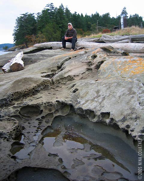 We walked all the park trails, rowed Darzee around the small bay, and
got to know Luis and Betty on their self-built steel Dutch-design
sailboat. A group of young kayakers was camping in tents on the point,
apparently unfazed by the rain.
As we sat in the cockpit drinking our afternoon coffee, a very nice,
large sailboat of about 55' approached the entrance range-marker.
Pirates Cove has a tricky channel with shoals either side. Cruising
guides give clear instructions, the charts show the proper channel, and
there are red and green markers. The sailboat was on course for
avoiding the long shoal extending out from the point, but instead of
turning sharply to port to enter the channel between the markers, the
skipper brought the boat close in to shore and proceeded to drive right
over the rocks! I stood up, my heart in my throat for them, and
expected to hear fiberglass crunching on rock any second. Luckily for
them, it was a very high tide and the boat didn't ground. I told Clark
we should dinghy over when they got anchored to advise them of their
mistake, so they wouldn't risk damaging their bottom on the way out.
We didn't get the chance! They made a quick U-turn around an anchored
boat from Australia and headed back out the way they came! "NO!" I
yelled. They looked toward us. "Keep the red buoy to port on your way
out!" I called, as loudly as I could to be heard over their engine. All
aboard smiled and waved, then continued over the rocks, even closer to
shore than before! Yikes! We were just about to turn on the VHF and
hail them before it was too late, when a little sport boat zoomed out
from the resident docks blowing their horn and yelling, "Keep the red
buoy to port!" They raced over to the sailboat, repeating the warning.
The sailboat continued to inch forward. What were they thinking? Surely
they were aware of their shallow depth sounder readings. Finally, the
little motor boat reached the side of the sailboat. The sailors finally
turned to pay attention to the repeated warning, asking "Keep the red
buoy to port?" The little boat turned around, waited for the big
sailboat to back away from the shoal, then showed them the proper way
out. We were left shaking our heads. If the tide hadn't been extremely
high... Even the float planes use the marked channel.
At least it wasn't raining when we left Pirates Cove and motored down
Trincomali Channel toward Montague Harbour on Galiano Island. A brisk
south wind was blowing on our nose, and the water was lumpy. We'd
arranged for Rikki-tikki to have dock space at Montague, November
through January. The harbormaster was waiting for us to sign documents
and pay the modest moorage fee. We anchored out in the bay, rowed to
the dock and left a voicemail from the pay phone. As we returned to
Rikki, the sun came out and a rainbow appeared over the marina and
harbor. Perhaps a good omen?
We walked all the park trails, rowed Darzee around the small bay, and
got to know Luis and Betty on their self-built steel Dutch-design
sailboat. A group of young kayakers was camping in tents on the point,
apparently unfazed by the rain.
As we sat in the cockpit drinking our afternoon coffee, a very nice,
large sailboat of about 55' approached the entrance range-marker.
Pirates Cove has a tricky channel with shoals either side. Cruising
guides give clear instructions, the charts show the proper channel, and
there are red and green markers. The sailboat was on course for
avoiding the long shoal extending out from the point, but instead of
turning sharply to port to enter the channel between the markers, the
skipper brought the boat close in to shore and proceeded to drive right
over the rocks! I stood up, my heart in my throat for them, and
expected to hear fiberglass crunching on rock any second. Luckily for
them, it was a very high tide and the boat didn't ground. I told Clark
we should dinghy over when they got anchored to advise them of their
mistake, so they wouldn't risk damaging their bottom on the way out.
We didn't get the chance! They made a quick U-turn around an anchored
boat from Australia and headed back out the way they came! "NO!" I
yelled. They looked toward us. "Keep the red buoy to port on your way
out!" I called, as loudly as I could to be heard over their engine. All
aboard smiled and waved, then continued over the rocks, even closer to
shore than before! Yikes! We were just about to turn on the VHF and
hail them before it was too late, when a little sport boat zoomed out
from the resident docks blowing their horn and yelling, "Keep the red
buoy to port!" They raced over to the sailboat, repeating the warning.
The sailboat continued to inch forward. What were they thinking? Surely
they were aware of their shallow depth sounder readings. Finally, the
little motor boat reached the side of the sailboat. The sailors finally
turned to pay attention to the repeated warning, asking "Keep the red
buoy to port?" The little boat turned around, waited for the big
sailboat to back away from the shoal, then showed them the proper way
out. We were left shaking our heads. If the tide hadn't been extremely
high... Even the float planes use the marked channel.
At least it wasn't raining when we left Pirates Cove and motored down
Trincomali Channel toward Montague Harbour on Galiano Island. A brisk
south wind was blowing on our nose, and the water was lumpy. We'd
arranged for Rikki-tikki to have dock space at Montague, November
through January. The harbormaster was waiting for us to sign documents
and pay the modest moorage fee. We anchored out in the bay, rowed to
the dock and left a voicemail from the pay phone. As we returned to
Rikki, the sun came out and a rainbow appeared over the marina and
harbor. Perhaps a good omen?
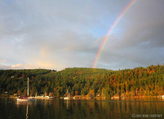 Turning away from the rainbow to face the setting sun, we saw that this
apparition of a shark had formed inside a cloud. Should we be worried?
Turning away from the rainbow to face the setting sun, we saw that this
apparition of a shark had formed inside a cloud. Should we be worried?
 Fortuitously, a comfortable place ashore has been made available on
Galiano. My aunt offered her lovely house for our use while Rikki is
tied to the dock. Its deck overlooks the BC Marine Park beach. It's a
bit of a hike up the road to the property, but we plan on having our
car brought up to BC. We'll be able to get some larger sewing projects
done indoors, while also doing some small home repair for auntie.
Having a carpenter in the house for a few months was one of the perks
for her. The biggest advantage is ours though, and we send our
heartfelt gratitude. We are looking forward to being on Galiano Island
and getting to know BC a bit better by car.
Another low was forecast to bring SE gales, so we took Rikki to Ganges
for groceries, doing email at the Saltspring public library. Then we
took refuge in the small inlet called Glenthorne Passage on Prevost
Island, just across the way. We'd be meeting up with Dave and Marcia on
Juniata in a few days.
Fair winds,
Clark & Nina
Fortuitously, a comfortable place ashore has been made available on
Galiano. My aunt offered her lovely house for our use while Rikki is
tied to the dock. Its deck overlooks the BC Marine Park beach. It's a
bit of a hike up the road to the property, but we plan on having our
car brought up to BC. We'll be able to get some larger sewing projects
done indoors, while also doing some small home repair for auntie.
Having a carpenter in the house for a few months was one of the perks
for her. The biggest advantage is ours though, and we send our
heartfelt gratitude. We are looking forward to being on Galiano Island
and getting to know BC a bit better by car.
Another low was forecast to bring SE gales, so we took Rikki to Ganges
for groceries, doing email at the Saltspring public library. Then we
took refuge in the small inlet called Glenthorne Passage on Prevost
Island, just across the way. We'd be meeting up with Dave and Marcia on
Juniata in a few days.
Fair winds,
Clark & Nina
Volume XI : Sturt & Smuggler
The cruising guide said to anchor in Caesar Cove, a little bight off
the south arm of Sturt Bay, but it looked way too tight. A private dock
farther in was stacked double-deep with fishing boats and they needed
room to get in and out. We like to stay out of the way. There was a
little marina, but we try to avoid paying dock fees. The bay itself was
very deep (82 feet), so we nosed around into its head looking for
shallower water. The tide was going to drop only five feet overnight so
no worries there. We wanted to swing with the winds when they came
because the rocky ledges around the bay looked hazardous. The spot we
chose to drop the anchor was fifty-five feet deep, right at the
entrance to the north arm of the bay, with a good bit of scope. We felt
pretty sure no other cruising boats would be coming in to impede our
swing.
We needed coffee, so we slid Darzee into the water and Clark rowed over to the docks. Hopefully, the store wouldn't be too much of a hike up the hill. Asking directions of a woman walking there, Clark scored a ride. The woman, from a sailboat on the transient dock, said she was on her way there for beer and steaks. The sun was out and they were going to barbeque. While Clark was at the store, a large freight boat came into the bay. "Marine Link Tours" and an 800-number in big block letters was painted on its square deck house. We'd seen the same boat at Tenedos Bay on September 8th. It pushed up to a gravel road at the bank behind Rikki-tikki, dropped a loading ramp, and started carting off sacks of heavy cargo with a forklift. Passengers up top observed the goings-on. We learned that this vessel offers paying customers a unique way to see BC as it picks up and delivers cargo throughout inaccessible islands and shoreline villages. Through the binocs I could see Clark back on the dock talking to the folks at the boat. I'd noticed their windvane and apparently he had too, so he was checking it out.
As Clark started back to Rikki-tikki in Darzee, a little orange-and-black tug pulling a similarly painted barge came steaming around the corner. I wondered where he was headed with that barge and how would he control it within the confines of the bay. I called Clark on the walkie-talkie as he began to row out to Rikki. "Do you see that barge coming in? Where do you suppose he's going to go?" The radio must've garbled my question because Clark thought I was talking about the freight boat that was already situated at the dock and so he continued rowing... right out in front of the tug! From his position behind the breakwater, Clark couldn't see the tug until he'd got out in front of it. The tug pulled over to the side of the barge and powered hard in reverse to take way off the barge. I suppose he would've been doing this anyway even without my husband rowing a little plastic dinghy across his path, but I was a bit worried. Barges don't have brakes.
Clark started paddling much faster when he finally caught sight of the barge as it came into the small bay under its own momentum. The tug lead the barge close in past the transient dock and directly into the "anchorage" of Caesar Cove, crossing right over the spot we'd decided NOT to drop anchor. Good choice. As the barge urged its mass toward the shore behind the Marine Link boat, the tug suddenly dropped the tow cable and zoomed out of its way. The skipper churned up white water with the tug's big engine, bringing its rubber-padded bow against the flanks of the barge. He deftly nudged the hulk to lie alongside a row of steel pilings. Quite impressive. I was thankful to be parked safely away from big boats moving about. As the sun settled behind Texada Island, our view across Malaspina Strait to the BC mainland became a monochromatic composition in blue.
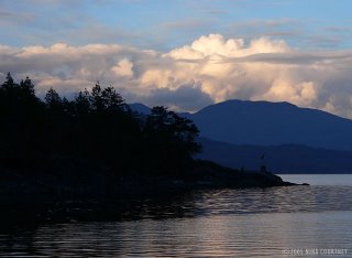 Next morning, October 1st, we hoisted the Delta anchor and motored out of
Sturt Bay, destined for Smuggler Cove, a popular BC Marine Park on the
Sechelt Peninsula. We were hoping it would give Rikki good protection
from more SE gales forecast for the 2nd, 4th, and 5th. The thunderheads
were building high and mighty over Texada and the mainland, the sun
hardening the edges and throwing glittering shards of light in our
eyes.
Next morning, October 1st, we hoisted the Delta anchor and motored out of
Sturt Bay, destined for Smuggler Cove, a popular BC Marine Park on the
Sechelt Peninsula. We were hoping it would give Rikki good protection
from more SE gales forecast for the 2nd, 4th, and 5th. The thunderheads
were building high and mighty over Texada and the mainland, the sun
hardening the edges and throwing glittering shards of light in our
eyes.
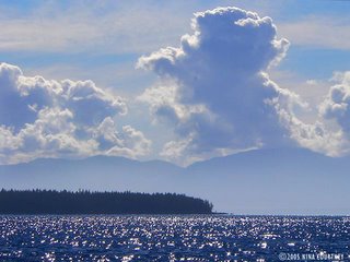 Smuggler Cove caution: "Proceed at dead-slow and post alert bow
lookouts." Encumbered by rocks, reefs, shoals and narrow passages, this
tiny small craft stopover, we are told, can harbor dozens of cruising
boats during peak summer months. I was just relieved there was nobody
else around! Entering the cove was not difficult– we took the advice of
"Exploring the South Coast of British Columbia" authors, the
Douglasses, and avoided the hazards. The tiny first basin was too open
to the SE for our comfort, the second not much better or much bigger.
The inner basin, with its extremely narrow, shallow passage, offered
the most shelter, so we went in – very slowly – with me posted as the
alert lookout, taking photos at the same time. It was a low tide but
there was eleven feet of water, leaving seven under Rikki's keelson.
Smuggler Cove caution: "Proceed at dead-slow and post alert bow
lookouts." Encumbered by rocks, reefs, shoals and narrow passages, this
tiny small craft stopover, we are told, can harbor dozens of cruising
boats during peak summer months. I was just relieved there was nobody
else around! Entering the cove was not difficult– we took the advice of
"Exploring the South Coast of British Columbia" authors, the
Douglasses, and avoided the hazards. The tiny first basin was too open
to the SE for our comfort, the second not much better or much bigger.
The inner basin, with its extremely narrow, shallow passage, offered
the most shelter, so we went in – very slowly – with me posted as the
alert lookout, taking photos at the same time. It was a low tide but
there was eleven feet of water, leaving seven under Rikki's keelson.
The lagoon inside was larger than we expected and, since we had the entire place to ourselves, we anchored in the middle in eighteen feet of water. We started noticing details as we settled in. There were dozens of orange rings drilled into the rock along rocky shore for use as stern line anchor points. A lot more rings revealed themselves as we rowed Darzee along the edges of the two outer basins, many of these seemed to be placed much too close to the numerous shoal areas. We were left questioning whether anyone would actually use them. We couldn't imagine the Cove harboring as many boats as there were rings! While we enjoyed hanging on anchor there for six nights, only three boats ventured into the inner basin and all three turned right around and went back out. Only four sailboats anchored in the outer basins overnight, usually only one at a time, and they were always out of our view except for the tip of their masts. We were secluded in our watery haven, visited only by an otter and two pair of loons, the resident belted kingfishers, a large pileated woodpecker, an osprey, the usual fleet of common mergansers and flocks of lovely varied thrushes.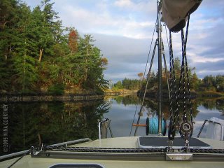 We heard voices. At the head of the lagoon, a group of hikers stopped
to read a marker. There was a trail! Finally, a place to get off the
boat and walk. But first things first, before the gale hit, we put the
motor on Darzee and motored over to Secret Cove, a mile to the north.
We hoped to find a grocery store for eggs and cream, but the marinas
looked shuttered for the season. At the Jolly Roger, a man on the docks
was carrying boat cushions up to his van, preparing to leave his
sailboat closed up for winter. We asked if there was a grocery. He said
the closest was five miles away in Halfmoon Bay. Jans offered to drive
us there, so we hopped into the van with the cushions and sailbags. The
Halfmoon Bay Grocery is a historic artifact of a building, whose owner
is from Pleasanton, CA. We've met numerous folks from the States,
enjoying a quieter life here in BC. We bought a bottle of bubbly to
celebrate our anniversary.
We heard voices. At the head of the lagoon, a group of hikers stopped
to read a marker. There was a trail! Finally, a place to get off the
boat and walk. But first things first, before the gale hit, we put the
motor on Darzee and motored over to Secret Cove, a mile to the north.
We hoped to find a grocery store for eggs and cream, but the marinas
looked shuttered for the season. At the Jolly Roger, a man on the docks
was carrying boat cushions up to his van, preparing to leave his
sailboat closed up for winter. We asked if there was a grocery. He said
the closest was five miles away in Halfmoon Bay. Jans offered to drive
us there, so we hopped into the van with the cushions and sailbags. The
Halfmoon Bay Grocery is a historic artifact of a building, whose owner
is from Pleasanton, CA. We've met numerous folks from the States,
enjoying a quieter life here in BC. We bought a bottle of bubbly to
celebrate our anniversary.
Back at the Jolly Roger, we made a few calls to home on the pay phone. It rained a lot at Smuggler Cove, especially on the 6th. The winds, when they arrived, went right over us through the top of the trees, leaving us unflustered. We walked the mossy, bouldered trails along the point to overlook Welcome Passage, Malaspina Strait, and Thormaby Island with its sandy beaches. This photo of the entrance to Smuggler Cove was taken at high tide, when the shoals and rocks are most hidden. Notice the blue sky and flat water? Environment Canada forecast gale winds across the Strait of Georgia this day, so we stayed put. They gave us a lovely day to stretch our legs while enjoying the sun. Over the next few days, we twice walked the longer trail, which had a
boardwalk over wetlands and passed through dense forest, even extending
our walk out toward Fishermans Cove along the road. We never got there
but we got in some good exercise. The bog trail was truly wonderful. It
went through several habitats and environments and offered sightings of
winter wren (I always pack the small binocs now) and some red mushrooms
with white spots. A pair of hikers with whom we got to chatting told us
what they were, but we've forgotten.
Over the next few days, we twice walked the longer trail, which had a
boardwalk over wetlands and passed through dense forest, even extending
our walk out toward Fishermans Cove along the road. We never got there
but we got in some good exercise. The bog trail was truly wonderful. It
went through several habitats and environments and offered sightings of
winter wren (I always pack the small binocs now) and some red mushrooms
with white spots. A pair of hikers with whom we got to chatting told us
what they were, but we've forgotten.
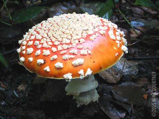 As we arrived at the road, a group of school children was trundling out
of cars and vans with their teachers for an excursion down the trail.
Smuggler Cove was once the home of "King of the Smugglers". It was once
profitable to assist Chinese laborers across the border into the US.
The trail markers also tell of the local Indians and how they used the
plants and resources of the area to live. It's a good place for a field
trip. We should've tagged along and learned even more about the Cove
and its history.
As we arrived at the road, a group of school children was trundling out
of cars and vans with their teachers for an excursion down the trail.
Smuggler Cove was once the home of "King of the Smugglers". It was once
profitable to assist Chinese laborers across the border into the US.
The trail markers also tell of the local Indians and how they used the
plants and resources of the area to live. It's a good place for a field
trip. We should've tagged along and learned even more about the Cove
and its history.
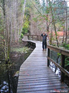 We motored over to Secret Cove again, for a more thorough exploration
of its shores– and five gallons of water. We went up and down each arm
of the large harbor, gawking at some impressive homes, one of which set
Clark's urge to build into high gear. It was a particularly
well-balanced neo-craftsman style, situated in the trees with a private
dock. I agreed that the design was both impressive and
comfortable-looking. We gazed at it for many minutes. Another, on a
picturesque point just across from Secret Cove Marina, was in the final
stages of completion. It looked as though it could be an Architectural
Digest feature home, with its contemporary lines, expansive angular
rock and slate entry, wide overhangs and large windows. A bit too
commercial-looking for our taste, but admirable.
We motored over to Secret Cove again, for a more thorough exploration
of its shores– and five gallons of water. We went up and down each arm
of the large harbor, gawking at some impressive homes, one of which set
Clark's urge to build into high gear. It was a particularly
well-balanced neo-craftsman style, situated in the trees with a private
dock. I agreed that the design was both impressive and
comfortable-looking. We gazed at it for many minutes. Another, on a
picturesque point just across from Secret Cove Marina, was in the final
stages of completion. It looked as though it could be an Architectural
Digest feature home, with its contemporary lines, expansive angular
rock and slate entry, wide overhangs and large windows. A bit too
commercial-looking for our taste, but admirable.
We listened several times a day to the marine forecast. The day we chose to leave for Silva Bay, about thirty miles across Georgia Strait on Gabriola Island, the voices crackling over the VHF predicted winds of less than ten knots. We experienced winds more in the 15-18 knot range. The "automated reports" claimed the "combined wind wave and swell height" at Halibut Bank to be "zero decimal three meters". As we passed by The Bank, we were splashing though waves obviously more than a meter high, not counting the SE swell! It was bumpy! We rolled out the jib and fell off the wind to pick up some speed, which we could do because the military activity zone "Whiskey Golf" was not active that day. It was "clear for transit". Crossing on this angle meant that when we reached Entrance Island, we'd have to motor directly into the wind for the last couple of miles. But, hey, we did that all the way up the West Coast, so nothing new there. Silva Bay was more busy and open to weather than we had become accustomed to but we anchored in front of Page's Marina to wait for another SE gale to pass over. We'd also have to time our transit through the rapids at Gabriola Passage, out of the Strait of Georgia and into Trincomali Channel. We were back in the Gulf Islands.
Fair winds, Clark & Nina
We needed coffee, so we slid Darzee into the water and Clark rowed over to the docks. Hopefully, the store wouldn't be too much of a hike up the hill. Asking directions of a woman walking there, Clark scored a ride. The woman, from a sailboat on the transient dock, said she was on her way there for beer and steaks. The sun was out and they were going to barbeque. While Clark was at the store, a large freight boat came into the bay. "Marine Link Tours" and an 800-number in big block letters was painted on its square deck house. We'd seen the same boat at Tenedos Bay on September 8th. It pushed up to a gravel road at the bank behind Rikki-tikki, dropped a loading ramp, and started carting off sacks of heavy cargo with a forklift. Passengers up top observed the goings-on. We learned that this vessel offers paying customers a unique way to see BC as it picks up and delivers cargo throughout inaccessible islands and shoreline villages. Through the binocs I could see Clark back on the dock talking to the folks at the boat. I'd noticed their windvane and apparently he had too, so he was checking it out.
As Clark started back to Rikki-tikki in Darzee, a little orange-and-black tug pulling a similarly painted barge came steaming around the corner. I wondered where he was headed with that barge and how would he control it within the confines of the bay. I called Clark on the walkie-talkie as he began to row out to Rikki. "Do you see that barge coming in? Where do you suppose he's going to go?" The radio must've garbled my question because Clark thought I was talking about the freight boat that was already situated at the dock and so he continued rowing... right out in front of the tug! From his position behind the breakwater, Clark couldn't see the tug until he'd got out in front of it. The tug pulled over to the side of the barge and powered hard in reverse to take way off the barge. I suppose he would've been doing this anyway even without my husband rowing a little plastic dinghy across his path, but I was a bit worried. Barges don't have brakes.
Clark started paddling much faster when he finally caught sight of the barge as it came into the small bay under its own momentum. The tug lead the barge close in past the transient dock and directly into the "anchorage" of Caesar Cove, crossing right over the spot we'd decided NOT to drop anchor. Good choice. As the barge urged its mass toward the shore behind the Marine Link boat, the tug suddenly dropped the tow cable and zoomed out of its way. The skipper churned up white water with the tug's big engine, bringing its rubber-padded bow against the flanks of the barge. He deftly nudged the hulk to lie alongside a row of steel pilings. Quite impressive. I was thankful to be parked safely away from big boats moving about. As the sun settled behind Texada Island, our view across Malaspina Strait to the BC mainland became a monochromatic composition in blue.
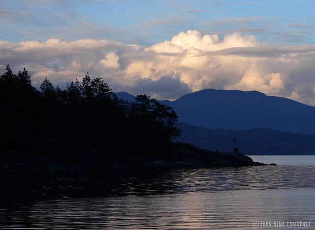 Next morning, October 1st, we hoisted the Delta anchor and motored out of
Sturt Bay, destined for Smuggler Cove, a popular BC Marine Park on the
Sechelt Peninsula. We were hoping it would give Rikki good protection
from more SE gales forecast for the 2nd, 4th, and 5th. The thunderheads
were building high and mighty over Texada and the mainland, the sun
hardening the edges and throwing glittering shards of light in our
eyes.
Next morning, October 1st, we hoisted the Delta anchor and motored out of
Sturt Bay, destined for Smuggler Cove, a popular BC Marine Park on the
Sechelt Peninsula. We were hoping it would give Rikki good protection
from more SE gales forecast for the 2nd, 4th, and 5th. The thunderheads
were building high and mighty over Texada and the mainland, the sun
hardening the edges and throwing glittering shards of light in our
eyes.
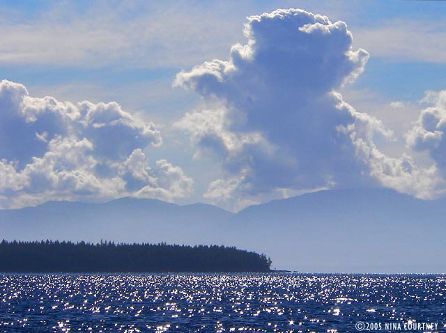 Smuggler Cove caution: "Proceed at dead-slow and post alert bow
lookouts." Encumbered by rocks, reefs, shoals and narrow passages, this
tiny small craft stopover, we are told, can harbor dozens of cruising
boats during peak summer months. I was just relieved there was nobody
else around! Entering the cove was not difficult– we took the advice of
"Exploring the South Coast of British Columbia" authors, the
Douglasses, and avoided the hazards. The tiny first basin was too open
to the SE for our comfort, the second not much better or much bigger.
The inner basin, with its extremely narrow, shallow passage, offered
the most shelter, so we went in – very slowly – with me posted as the
alert lookout, taking photos at the same time. It was a low tide but
there was eleven feet of water, leaving seven under Rikki's keelson.
Smuggler Cove caution: "Proceed at dead-slow and post alert bow
lookouts." Encumbered by rocks, reefs, shoals and narrow passages, this
tiny small craft stopover, we are told, can harbor dozens of cruising
boats during peak summer months. I was just relieved there was nobody
else around! Entering the cove was not difficult– we took the advice of
"Exploring the South Coast of British Columbia" authors, the
Douglasses, and avoided the hazards. The tiny first basin was too open
to the SE for our comfort, the second not much better or much bigger.
The inner basin, with its extremely narrow, shallow passage, offered
the most shelter, so we went in – very slowly – with me posted as the
alert lookout, taking photos at the same time. It was a low tide but
there was eleven feet of water, leaving seven under Rikki's keelson.The lagoon inside was larger than we expected and, since we had the entire place to ourselves, we anchored in the middle in eighteen feet of water. We started noticing details as we settled in. There were dozens of orange rings drilled into the rock along rocky shore for use as stern line anchor points. A lot more rings revealed themselves as we rowed Darzee along the edges of the two outer basins, many of these seemed to be placed much too close to the numerous shoal areas. We were left questioning whether anyone would actually use them. We couldn't imagine the Cove harboring as many boats as there were rings! While we enjoyed hanging on anchor there for six nights, only three boats ventured into the inner basin and all three turned right around and went back out. Only four sailboats anchored in the outer basins overnight, usually only one at a time, and they were always out of our view except for the tip of their masts. We were secluded in our watery haven, visited only by an otter and two pair of loons, the resident belted kingfishers, a large pileated woodpecker, an osprey, the usual fleet of common mergansers and flocks of lovely varied thrushes.
 We heard voices. At the head of the lagoon, a group of hikers stopped
to read a marker. There was a trail! Finally, a place to get off the
boat and walk. But first things first, before the gale hit, we put the
motor on Darzee and motored over to Secret Cove, a mile to the north.
We hoped to find a grocery store for eggs and cream, but the marinas
looked shuttered for the season. At the Jolly Roger, a man on the docks
was carrying boat cushions up to his van, preparing to leave his
sailboat closed up for winter. We asked if there was a grocery. He said
the closest was five miles away in Halfmoon Bay. Jans offered to drive
us there, so we hopped into the van with the cushions and sailbags. The
Halfmoon Bay Grocery is a historic artifact of a building, whose owner
is from Pleasanton, CA. We've met numerous folks from the States,
enjoying a quieter life here in BC. We bought a bottle of bubbly to
celebrate our anniversary.
We heard voices. At the head of the lagoon, a group of hikers stopped
to read a marker. There was a trail! Finally, a place to get off the
boat and walk. But first things first, before the gale hit, we put the
motor on Darzee and motored over to Secret Cove, a mile to the north.
We hoped to find a grocery store for eggs and cream, but the marinas
looked shuttered for the season. At the Jolly Roger, a man on the docks
was carrying boat cushions up to his van, preparing to leave his
sailboat closed up for winter. We asked if there was a grocery. He said
the closest was five miles away in Halfmoon Bay. Jans offered to drive
us there, so we hopped into the van with the cushions and sailbags. The
Halfmoon Bay Grocery is a historic artifact of a building, whose owner
is from Pleasanton, CA. We've met numerous folks from the States,
enjoying a quieter life here in BC. We bought a bottle of bubbly to
celebrate our anniversary.Back at the Jolly Roger, we made a few calls to home on the pay phone. It rained a lot at Smuggler Cove, especially on the 6th. The winds, when they arrived, went right over us through the top of the trees, leaving us unflustered. We walked the mossy, bouldered trails along the point to overlook Welcome Passage, Malaspina Strait, and Thormaby Island with its sandy beaches. This photo of the entrance to Smuggler Cove was taken at high tide, when the shoals and rocks are most hidden. Notice the blue sky and flat water? Environment Canada forecast gale winds across the Strait of Georgia this day, so we stayed put. They gave us a lovely day to stretch our legs while enjoying the sun.
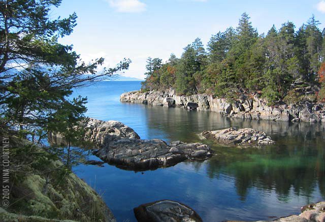 Over the next few days, we twice walked the longer trail, which had a
boardwalk over wetlands and passed through dense forest, even extending
our walk out toward Fishermans Cove along the road. We never got there
but we got in some good exercise. The bog trail was truly wonderful. It
went through several habitats and environments and offered sightings of
winter wren (I always pack the small binocs now) and some red mushrooms
with white spots. A pair of hikers with whom we got to chatting told us
what they were, but we've forgotten.
Over the next few days, we twice walked the longer trail, which had a
boardwalk over wetlands and passed through dense forest, even extending
our walk out toward Fishermans Cove along the road. We never got there
but we got in some good exercise. The bog trail was truly wonderful. It
went through several habitats and environments and offered sightings of
winter wren (I always pack the small binocs now) and some red mushrooms
with white spots. A pair of hikers with whom we got to chatting told us
what they were, but we've forgotten.
 As we arrived at the road, a group of school children was trundling out
of cars and vans with their teachers for an excursion down the trail.
Smuggler Cove was once the home of "King of the Smugglers". It was once
profitable to assist Chinese laborers across the border into the US.
The trail markers also tell of the local Indians and how they used the
plants and resources of the area to live. It's a good place for a field
trip. We should've tagged along and learned even more about the Cove
and its history.
As we arrived at the road, a group of school children was trundling out
of cars and vans with their teachers for an excursion down the trail.
Smuggler Cove was once the home of "King of the Smugglers". It was once
profitable to assist Chinese laborers across the border into the US.
The trail markers also tell of the local Indians and how they used the
plants and resources of the area to live. It's a good place for a field
trip. We should've tagged along and learned even more about the Cove
and its history.
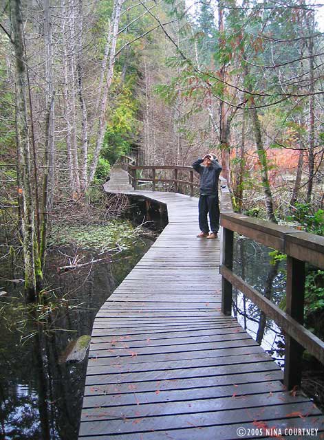 We motored over to Secret Cove again, for a more thorough exploration
of its shores– and five gallons of water. We went up and down each arm
of the large harbor, gawking at some impressive homes, one of which set
Clark's urge to build into high gear. It was a particularly
well-balanced neo-craftsman style, situated in the trees with a private
dock. I agreed that the design was both impressive and
comfortable-looking. We gazed at it for many minutes. Another, on a
picturesque point just across from Secret Cove Marina, was in the final
stages of completion. It looked as though it could be an Architectural
Digest feature home, with its contemporary lines, expansive angular
rock and slate entry, wide overhangs and large windows. A bit too
commercial-looking for our taste, but admirable.
We motored over to Secret Cove again, for a more thorough exploration
of its shores– and five gallons of water. We went up and down each arm
of the large harbor, gawking at some impressive homes, one of which set
Clark's urge to build into high gear. It was a particularly
well-balanced neo-craftsman style, situated in the trees with a private
dock. I agreed that the design was both impressive and
comfortable-looking. We gazed at it for many minutes. Another, on a
picturesque point just across from Secret Cove Marina, was in the final
stages of completion. It looked as though it could be an Architectural
Digest feature home, with its contemporary lines, expansive angular
rock and slate entry, wide overhangs and large windows. A bit too
commercial-looking for our taste, but admirable.We listened several times a day to the marine forecast. The day we chose to leave for Silva Bay, about thirty miles across Georgia Strait on Gabriola Island, the voices crackling over the VHF predicted winds of less than ten knots. We experienced winds more in the 15-18 knot range. The "automated reports" claimed the "combined wind wave and swell height" at Halibut Bank to be "zero decimal three meters". As we passed by The Bank, we were splashing though waves obviously more than a meter high, not counting the SE swell! It was bumpy! We rolled out the jib and fell off the wind to pick up some speed, which we could do because the military activity zone "Whiskey Golf" was not active that day. It was "clear for transit". Crossing on this angle meant that when we reached Entrance Island, we'd have to motor directly into the wind for the last couple of miles. But, hey, we did that all the way up the West Coast, so nothing new there. Silva Bay was more busy and open to weather than we had become accustomed to but we anchored in front of Page's Marina to wait for another SE gale to pass over. We'd also have to time our transit through the rapids at Gabriola Passage, out of the Strait of Georgia and into Trincomali Channel. We were back in the Gulf Islands.
Fair winds, Clark & Nina
The Gorge
Volume X: The Gorge
"The Gorge", a half-mile long, 200-foot wide passage with nearly
vertical walls, frames the nearly centered entrance to a land-locked
harbor, not surprisingly named Gorge Harbour. It is an impressive,
protecting door, with up to a four knot current when the tide is
running. As we slid by the high west wall, we failed to spot the
remnants of Indian rock paintings that decorate it. On the east, the
boulders are said to have formed burial caverns. SE gales were
forecast, so we turned left once inside the harbor to find a spot for a
snug stern-tie along the south shore.
Gorge Harbour Resort was just across from where we anchored, looking
very unprotected along the north shore, though there were only three
boats in the slips. Music was blaring across the water as we rowed
over. It wasn't from the restaurant, but from a stereo system in a
house right next door, all doors and windows open. Several young people
were lounging in chairs on the deck. It looked like a frat house party.
We bought some wine at the tiny resort store. A passerby told us that
the restaurant served excellent food. The creative selections on the
menu sounded delicious, but the high prices (and the loud music) sent
us paddling back to Rikki-tikki. We wondered how the restaurant
proprietors felt about their neighbors.
The breeze started to pick up and a small sailboat with no engine came
in, also seeking shelter. The skipper, alone, worked like the devil
attempting to reach the marina docks. He tacked and jibed, back and
forth, again and again, but he was unable to get close enough to safely
tie up and there was nobody to help. Just before it got too dark to
see, he fell off downwind past the marina where he threw out an anchor.
The wind died away and we slept well tucked into our little niche of
rocky shore. As the sky lightened next morning, I awoke and peeked out
the portlight on my side of the bed. The sky was lit up all pink and
violet, with golden highlights, colors displayed on a plethora of
wind-driven clouds, clouds piling up, lines of stratus clouds. I leaped
out of bed and pulled on my fleece, grabbed my Lumix FZ20 and was out
on the deck snapping photos lickety-split. As a rule, I don't open my
eyes at dawn or leap out of bed for anything, even Clark's coffee, so
this sky had to be something special.
When I got out on deck, it looked like this...
 The sky put on a marvelous show as our side of Earth turned slowly
toward the sun's brilliance. I took many photos, but these capture two
of the infinite faces one sunrise can show.
The sky put on a marvelous show as our side of Earth turned slowly
toward the sun's brilliance. I took many photos, but these capture two
of the infinite faces one sunrise can show.
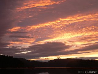 It was A Most Spectacular Sunrise! But, the entire time we were ooohing
and aaahing at the sun's glorious introduction to our day, the sailor's
ditty, "Red sky at night, sailor's delight. Red sky in the morning,
sailor take warning," was ringing in our ears. It didn't take long for
the front of clouds to completely obscure the sun once again.
Before we finished breakfast, the wind started up again, this time like
it wasn't going to let up for quite a while. Whooshing toward
Rikki-tikki from the NE, instead of SE, it raised a significantly
uncomfortable chop on its way across the harbor. Rikki was being pushed
sideways by the gusts, splashing up and down on the building waves. We
knew it would only get worse, so we decided to move. We started the
engine, double-tied Darzee, who was between the hulls, then Clark
released the sternline and rolled it in as fast as he could. His stern
now free, and Clark still rolling in line, Rikki swung toward the rocky
shore. I used the engine to hold position, trying not to drive over the
anchor. With the sternline finally secured, Clark went forward to raise
the Delta.
We got away clean and headed into the wind, making a beeline for the
east side of the bay. We passed by The Gorge to look for an area where
the wind wasn't stirring up the water. Inside a rocky peninsula, we
spotted a quiet little bight and went in for a look. The water was
forty-two feet deep with lots of room to let out enough scope and let
Rikki swing unfettered. We crossed our fingers that this would prove to
be a great spot. It did– as the winds gusted above, they barely ruffled
Rikki-tikki's fur. It rained and blew, but we felt safe.
Between rain showers, we rowed Darzee into the lagoon behind us to see
what we could see. It was an oyster lease area and there were grids of
wire nets stapled to the gravel bottom. A small stream flowed into the
saltwater, creating perfect conditions for the bivalves, though there
weren't many. Perhaps they'd been harvested. Out in the bay, we saw
quite a few aquaculture floats, which were attended by yellow
rain-slickered men in aluminum runabouts. One fellow must've been the
harbor go-between (or busy-body) because he roared back and forth
constantly, at top speed, from one end of the harbor to the other, all
day long. After weeks of quiet anchorages, the noise was unsettling.
Even from our new spot far away from the Resort, we could hear the
on-going party music echoing across the water.
It was A Most Spectacular Sunrise! But, the entire time we were ooohing
and aaahing at the sun's glorious introduction to our day, the sailor's
ditty, "Red sky at night, sailor's delight. Red sky in the morning,
sailor take warning," was ringing in our ears. It didn't take long for
the front of clouds to completely obscure the sun once again.
Before we finished breakfast, the wind started up again, this time like
it wasn't going to let up for quite a while. Whooshing toward
Rikki-tikki from the NE, instead of SE, it raised a significantly
uncomfortable chop on its way across the harbor. Rikki was being pushed
sideways by the gusts, splashing up and down on the building waves. We
knew it would only get worse, so we decided to move. We started the
engine, double-tied Darzee, who was between the hulls, then Clark
released the sternline and rolled it in as fast as he could. His stern
now free, and Clark still rolling in line, Rikki swung toward the rocky
shore. I used the engine to hold position, trying not to drive over the
anchor. With the sternline finally secured, Clark went forward to raise
the Delta.
We got away clean and headed into the wind, making a beeline for the
east side of the bay. We passed by The Gorge to look for an area where
the wind wasn't stirring up the water. Inside a rocky peninsula, we
spotted a quiet little bight and went in for a look. The water was
forty-two feet deep with lots of room to let out enough scope and let
Rikki swing unfettered. We crossed our fingers that this would prove to
be a great spot. It did– as the winds gusted above, they barely ruffled
Rikki-tikki's fur. It rained and blew, but we felt safe.
Between rain showers, we rowed Darzee into the lagoon behind us to see
what we could see. It was an oyster lease area and there were grids of
wire nets stapled to the gravel bottom. A small stream flowed into the
saltwater, creating perfect conditions for the bivalves, though there
weren't many. Perhaps they'd been harvested. Out in the bay, we saw
quite a few aquaculture floats, which were attended by yellow
rain-slickered men in aluminum runabouts. One fellow must've been the
harbor go-between (or busy-body) because he roared back and forth
constantly, at top speed, from one end of the harbor to the other, all
day long. After weeks of quiet anchorages, the noise was unsettling.
Even from our new spot far away from the Resort, we could hear the
on-going party music echoing across the water.
 A small, unfinished cabin enjoyed a great location on the promontory. I
spotted three mergansers that looked different from the common ones we
saw at nearly every anchorage. They were hooded mergansers! An eagle
perched on a tree above and a beautiful loon entertained us as he dived
for fish beside the boat. Our little inlet was lovely, its edges framed
by handsomely arranged boulders, some of which were black obsidian. The
mist-shrouded conifers and arbutus created a curtain– we could almost
ignore the cacophony outside.
A small, unfinished cabin enjoyed a great location on the promontory. I
spotted three mergansers that looked different from the common ones we
saw at nearly every anchorage. They were hooded mergansers! An eagle
perched on a tree above and a beautiful loon entertained us as he dived
for fish beside the boat. Our little inlet was lovely, its edges framed
by handsomely arranged boulders, some of which were black obsidian. The
mist-shrouded conifers and arbutus created a curtain– we could almost
ignore the cacophony outside.
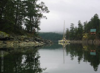 Finally, the storm moved on, leaving only stillness, so we weighed
anchor. The Gorge, mirrored perfectly in the gray morning light, framed
our course down Malaspina Strait toward Texada Island. With only a day
or two before the next front, this time with forecast NE winds, we
thought Sturt Bay might be a good place to hide.
Finally, the storm moved on, leaving only stillness, so we weighed
anchor. The Gorge, mirrored perfectly in the gray morning light, framed
our course down Malaspina Strait toward Texada Island. With only a day
or two before the next front, this time with forecast NE winds, we
thought Sturt Bay might be a good place to hide.
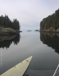 Smooth seas,
Clark & Nina
Smooth seas,
Clark & Nina
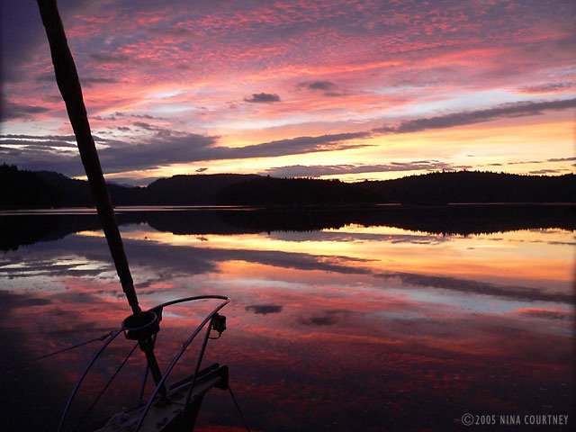 The sky put on a marvelous show as our side of Earth turned slowly
toward the sun's brilliance. I took many photos, but these capture two
of the infinite faces one sunrise can show.
The sky put on a marvelous show as our side of Earth turned slowly
toward the sun's brilliance. I took many photos, but these capture two
of the infinite faces one sunrise can show.
 It was A Most Spectacular Sunrise! But, the entire time we were ooohing
and aaahing at the sun's glorious introduction to our day, the sailor's
ditty, "Red sky at night, sailor's delight. Red sky in the morning,
sailor take warning," was ringing in our ears. It didn't take long for
the front of clouds to completely obscure the sun once again.
Before we finished breakfast, the wind started up again, this time like
it wasn't going to let up for quite a while. Whooshing toward
Rikki-tikki from the NE, instead of SE, it raised a significantly
uncomfortable chop on its way across the harbor. Rikki was being pushed
sideways by the gusts, splashing up and down on the building waves. We
knew it would only get worse, so we decided to move. We started the
engine, double-tied Darzee, who was between the hulls, then Clark
released the sternline and rolled it in as fast as he could. His stern
now free, and Clark still rolling in line, Rikki swung toward the rocky
shore. I used the engine to hold position, trying not to drive over the
anchor. With the sternline finally secured, Clark went forward to raise
the Delta.
We got away clean and headed into the wind, making a beeline for the
east side of the bay. We passed by The Gorge to look for an area where
the wind wasn't stirring up the water. Inside a rocky peninsula, we
spotted a quiet little bight and went in for a look. The water was
forty-two feet deep with lots of room to let out enough scope and let
Rikki swing unfettered. We crossed our fingers that this would prove to
be a great spot. It did– as the winds gusted above, they barely ruffled
Rikki-tikki's fur. It rained and blew, but we felt safe.
Between rain showers, we rowed Darzee into the lagoon behind us to see
what we could see. It was an oyster lease area and there were grids of
wire nets stapled to the gravel bottom. A small stream flowed into the
saltwater, creating perfect conditions for the bivalves, though there
weren't many. Perhaps they'd been harvested. Out in the bay, we saw
quite a few aquaculture floats, which were attended by yellow
rain-slickered men in aluminum runabouts. One fellow must've been the
harbor go-between (or busy-body) because he roared back and forth
constantly, at top speed, from one end of the harbor to the other, all
day long. After weeks of quiet anchorages, the noise was unsettling.
Even from our new spot far away from the Resort, we could hear the
on-going party music echoing across the water.
It was A Most Spectacular Sunrise! But, the entire time we were ooohing
and aaahing at the sun's glorious introduction to our day, the sailor's
ditty, "Red sky at night, sailor's delight. Red sky in the morning,
sailor take warning," was ringing in our ears. It didn't take long for
the front of clouds to completely obscure the sun once again.
Before we finished breakfast, the wind started up again, this time like
it wasn't going to let up for quite a while. Whooshing toward
Rikki-tikki from the NE, instead of SE, it raised a significantly
uncomfortable chop on its way across the harbor. Rikki was being pushed
sideways by the gusts, splashing up and down on the building waves. We
knew it would only get worse, so we decided to move. We started the
engine, double-tied Darzee, who was between the hulls, then Clark
released the sternline and rolled it in as fast as he could. His stern
now free, and Clark still rolling in line, Rikki swung toward the rocky
shore. I used the engine to hold position, trying not to drive over the
anchor. With the sternline finally secured, Clark went forward to raise
the Delta.
We got away clean and headed into the wind, making a beeline for the
east side of the bay. We passed by The Gorge to look for an area where
the wind wasn't stirring up the water. Inside a rocky peninsula, we
spotted a quiet little bight and went in for a look. The water was
forty-two feet deep with lots of room to let out enough scope and let
Rikki swing unfettered. We crossed our fingers that this would prove to
be a great spot. It did– as the winds gusted above, they barely ruffled
Rikki-tikki's fur. It rained and blew, but we felt safe.
Between rain showers, we rowed Darzee into the lagoon behind us to see
what we could see. It was an oyster lease area and there were grids of
wire nets stapled to the gravel bottom. A small stream flowed into the
saltwater, creating perfect conditions for the bivalves, though there
weren't many. Perhaps they'd been harvested. Out in the bay, we saw
quite a few aquaculture floats, which were attended by yellow
rain-slickered men in aluminum runabouts. One fellow must've been the
harbor go-between (or busy-body) because he roared back and forth
constantly, at top speed, from one end of the harbor to the other, all
day long. After weeks of quiet anchorages, the noise was unsettling.
Even from our new spot far away from the Resort, we could hear the
on-going party music echoing across the water.
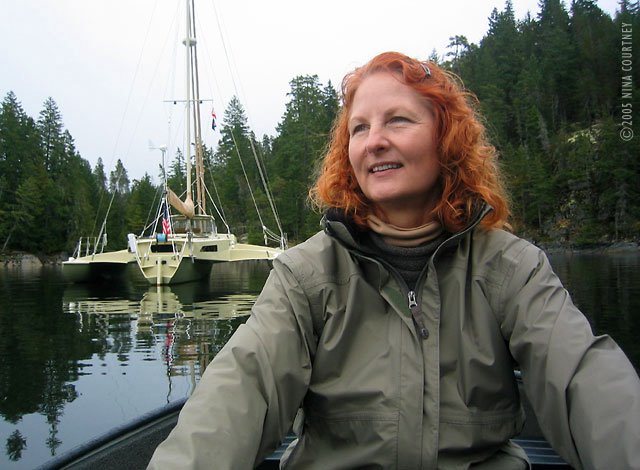 A small, unfinished cabin enjoyed a great location on the promontory. I
spotted three mergansers that looked different from the common ones we
saw at nearly every anchorage. They were hooded mergansers! An eagle
perched on a tree above and a beautiful loon entertained us as he dived
for fish beside the boat. Our little inlet was lovely, its edges framed
by handsomely arranged boulders, some of which were black obsidian. The
mist-shrouded conifers and arbutus created a curtain– we could almost
ignore the cacophony outside.
A small, unfinished cabin enjoyed a great location on the promontory. I
spotted three mergansers that looked different from the common ones we
saw at nearly every anchorage. They were hooded mergansers! An eagle
perched on a tree above and a beautiful loon entertained us as he dived
for fish beside the boat. Our little inlet was lovely, its edges framed
by handsomely arranged boulders, some of which were black obsidian. The
mist-shrouded conifers and arbutus created a curtain– we could almost
ignore the cacophony outside.
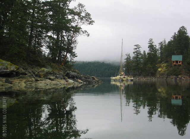 Finally, the storm moved on, leaving only stillness, so we weighed
anchor. The Gorge, mirrored perfectly in the gray morning light, framed
our course down Malaspina Strait toward Texada Island. With only a day
or two before the next front, this time with forecast NE winds, we
thought Sturt Bay might be a good place to hide.
Finally, the storm moved on, leaving only stillness, so we weighed
anchor. The Gorge, mirrored perfectly in the gray morning light, framed
our course down Malaspina Strait toward Texada Island. With only a day
or two before the next front, this time with forecast NE winds, we
thought Sturt Bay might be a good place to hide.
 Smooth seas,
Clark & Nina
Smooth seas,
Clark & Nina
Monday, October 31, 2005
Back to The Spit
Volume IX: Back to The Spit
As you remember, way back when we last wrote, we were headed for Surge
Narrows, a skinny rapids (197 feet wide at its minimum) that must be
navigated only at or near slack water, the duration of which varies
from five to eleven minutes. Not very long! We timed our arrival
perfectly and transited easily with no other boats to contend with in
the confined channel. We can imagine how stressful a transit might
become when there are many boats wanting to go through at the same
time. The Narrows deserves respect. We were aware of a boat that got
hung up on Tusko Rock this summer, so we were very cautious. Mr. Tides,
a tide and current software for Macintosh, helped us plan our timing.
GPSNavX, our computer charting software, plotted our course on the BSB
chart with coordinates from our Garmin 48 in real time. We send our
kudos and thanks to Rich, the author of GPSNavX, and to August, the
author of Mr. Tides, for their fabulous software!
The day was mostly sunny with a faint breeze, not enough to sail until
we reached the end of Hoskyn Channel when we rolled out the jib briefly
to take advantage of a more defined flow of air of 20 knots from the
NW. It's either no wind or a lot of wind around BC! We were considering
seeking shelter in Village Bay to escape the wind, but when we turned
the corner at The Spit, we could see that there was smooth water inside
its arm of scrubby trees.
Rebecca Spit was vacant of boats so we chose the "prime view" anchoring
spot at the opening in The Spit– looking east across the northern
reaches of the Strait of Georgia to the layers of mountains on the
mainland. We hanged the bow anchor to our 33-pound Delta and stowed the
Northill. The Northill is a great anchor– lightweight, easy to set, and
it has never dragged. It wrapped up a loop of the rode a few times, so
we started using a ten pound lead ball as an additional weight on the
rode to increase the catenary. At Von Donop we lazily tippy-toed
around our anchor and, even with the extra weight, the Northill came up
so entangled in the rode and chain that it looked like a Chinese string
puzzle! We decided to trust it only when we stern-tied ashore. When
Rikki-tikki would be swinging in different directions with the changing
tide and winds, the Delta could be trusted to hold without fouling and
we would sleep better.
We had the afternoon open (what else is new?) so 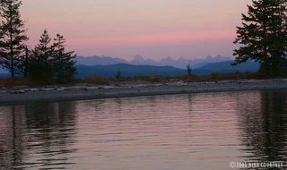 we launched Darzee and
motored over to Heriot Bay for groceries and wireless internet down in
the Inn's laundry room while running a load. Another boat down from the
Octopus Islands was at the marina. He latter came to The Spit and
anchored real close to us (what else is new!?), but Clark warned him
that we had a lot of scope out so he pulled a line to a log ashore and
backed away. I managed to get a photo of the view before he arrived and
planted himself in the middle of it.
We spotted a little fleet of colorfully-painted Harlequin ducks, four
drakes with six in their harem. We'd never seen Harlequins before; we
strained our eyes admiring them. The drakes are stunning to look at and
impossible to photograph– so shy. Another sailboat came in just as
evening arrived but he chose wisely and allowed plenty of swinging room
for both of us. His boat is the counterpoint to the gorgeous sky we all
enjoyed.
we launched Darzee and
motored over to Heriot Bay for groceries and wireless internet down in
the Inn's laundry room while running a load. Another boat down from the
Octopus Islands was at the marina. He latter came to The Spit and
anchored real close to us (what else is new!?), but Clark warned him
that we had a lot of scope out so he pulled a line to a log ashore and
backed away. I managed to get a photo of the view before he arrived and
planted himself in the middle of it.
We spotted a little fleet of colorfully-painted Harlequin ducks, four
drakes with six in their harem. We'd never seen Harlequins before; we
strained our eyes admiring them. The drakes are stunning to look at and
impossible to photograph– so shy. Another sailboat came in just as
evening arrived but he chose wisely and allowed plenty of swinging room
for both of us. His boat is the counterpoint to the gorgeous sky we all
enjoyed.
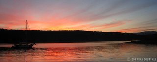 Rikki-tikki-tavi made big arcs over the water as the tide came and
went, rocking a bit with the Whaletown ferry wake, but the wind
remained calm. Fall was in the air and the guests at the resort were
lounging in the sun overlooking the harbor. Kayakers paddled about and
campers walked their dogs along The Spit trail out to the tip. The
color of maple leaves turning vibrant hues accented the hillsides. It
was a relaxed atmosphere, no crowds of cruising boats from the US
bustling in and out of the marina, just the locals coming out to enjoy
the peace. In all, we made three trips to send and receive email,
download the latest version of GPSNavX, and do banking online. Thank
you, Heriot Bay!
Rikki-tikki-tavi made big arcs over the water as the tide came and
went, rocking a bit with the Whaletown ferry wake, but the wind
remained calm. Fall was in the air and the guests at the resort were
lounging in the sun overlooking the harbor. Kayakers paddled about and
campers walked their dogs along The Spit trail out to the tip. The
color of maple leaves turning vibrant hues accented the hillsides. It
was a relaxed atmosphere, no crowds of cruising boats from the US
bustling in and out of the marina, just the locals coming out to enjoy
the peace. In all, we made three trips to send and receive email,
download the latest version of GPSNavX, and do banking online. Thank
you, Heriot Bay!
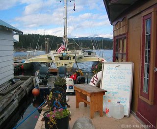 A big low pressure system was predicted to bring strong SE winds, so we
took Rikki-tikki to Heriot Bay for fuel, once again squeezing him in
backwards between the ferry landing and the docks. Clark can maneuver
him into some very small spaces! The ferry comes in just beyond the
little floating store on the right in this photo.
Gorge Harbour, on the south side of Cortes Island, beckoned with
promised protection from SE gales and we hadn't been there yet, so off
we went, motoring along under, yet again, amazing skies. It just
doesn't get boring! Each day's atmosphere and appearance is
surprisingly different from the one before. Even when it's silvery gray
or raining, the infinite variety of reflections, shapes and light give
us much pleasure.
A big low pressure system was predicted to bring strong SE winds, so we
took Rikki-tikki to Heriot Bay for fuel, once again squeezing him in
backwards between the ferry landing and the docks. Clark can maneuver
him into some very small spaces! The ferry comes in just beyond the
little floating store on the right in this photo.
Gorge Harbour, on the south side of Cortes Island, beckoned with
promised protection from SE gales and we hadn't been there yet, so off
we went, motoring along under, yet again, amazing skies. It just
doesn't get boring! Each day's atmosphere and appearance is
surprisingly different from the one before. Even when it's silvery gray
or raining, the infinite variety of reflections, shapes and light give
us much pleasure.
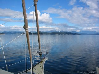 I was hoping to see Shark Spit. We had to pass by it, through Z-shaped, tricky Uganda Passage, on the way to Gorge Harbour. I wanted to see if it was the place I remembered visiting while cruising with my grandparents as a teenager. The low-lying spit back then was so thick with live sand dollars of every size that there was little room for sand! It was impossible not to crunch them as one walked. We spent a sunny afternoon there, fascinated by the multiple layers of the spiny creatures, marveling in their purple billions. We lined up rows of graduated sizes, from the tiniest, smaller than ones baby finger, all the way to specimens a couple of inches across. Now I feared that they would be no more, but the time wasn't right to find out. The tide was very high and Shark Spit was hidden beneath the waves. I would have to wait for another visit, hopefully when a gale wasn't on its way.
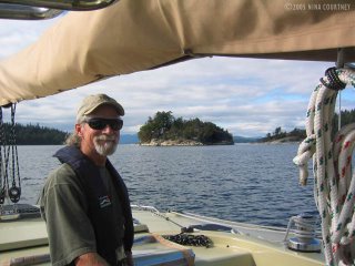 If we could buy an island, this would be the one. An islet next to
Shark Spit, it has just the right combination of rocky outcroppings and
protecting trees, a small bay for Rikki-tikki, and a great location for
a house with a dynamite view. There was already a house there of
course, with a guest cottage no less. Someone else owns Clark's Island.
Fair winds,
Clark & Nina
If we could buy an island, this would be the one. An islet next to
Shark Spit, it has just the right combination of rocky outcroppings and
protecting trees, a small bay for Rikki-tikki, and a great location for
a house with a dynamite view. There was already a house there of
course, with a guest cottage no less. Someone else owns Clark's Island.
Fair winds,
Clark & Nina
 we launched Darzee and
motored over to Heriot Bay for groceries and wireless internet down in
the Inn's laundry room while running a load. Another boat down from the
Octopus Islands was at the marina. He latter came to The Spit and
anchored real close to us (what else is new!?), but Clark warned him
that we had a lot of scope out so he pulled a line to a log ashore and
backed away. I managed to get a photo of the view before he arrived and
planted himself in the middle of it.
We spotted a little fleet of colorfully-painted Harlequin ducks, four
drakes with six in their harem. We'd never seen Harlequins before; we
strained our eyes admiring them. The drakes are stunning to look at and
impossible to photograph– so shy. Another sailboat came in just as
evening arrived but he chose wisely and allowed plenty of swinging room
for both of us. His boat is the counterpoint to the gorgeous sky we all
enjoyed.
we launched Darzee and
motored over to Heriot Bay for groceries and wireless internet down in
the Inn's laundry room while running a load. Another boat down from the
Octopus Islands was at the marina. He latter came to The Spit and
anchored real close to us (what else is new!?), but Clark warned him
that we had a lot of scope out so he pulled a line to a log ashore and
backed away. I managed to get a photo of the view before he arrived and
planted himself in the middle of it.
We spotted a little fleet of colorfully-painted Harlequin ducks, four
drakes with six in their harem. We'd never seen Harlequins before; we
strained our eyes admiring them. The drakes are stunning to look at and
impossible to photograph– so shy. Another sailboat came in just as
evening arrived but he chose wisely and allowed plenty of swinging room
for both of us. His boat is the counterpoint to the gorgeous sky we all
enjoyed.
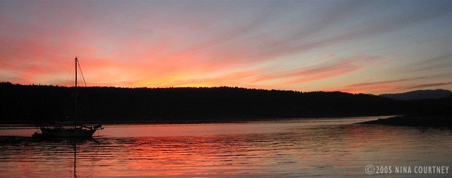 Rikki-tikki-tavi made big arcs over the water as the tide came and
went, rocking a bit with the Whaletown ferry wake, but the wind
remained calm. Fall was in the air and the guests at the resort were
lounging in the sun overlooking the harbor. Kayakers paddled about and
campers walked their dogs along The Spit trail out to the tip. The
color of maple leaves turning vibrant hues accented the hillsides. It
was a relaxed atmosphere, no crowds of cruising boats from the US
bustling in and out of the marina, just the locals coming out to enjoy
the peace. In all, we made three trips to send and receive email,
download the latest version of GPSNavX, and do banking online. Thank
you, Heriot Bay!
Rikki-tikki-tavi made big arcs over the water as the tide came and
went, rocking a bit with the Whaletown ferry wake, but the wind
remained calm. Fall was in the air and the guests at the resort were
lounging in the sun overlooking the harbor. Kayakers paddled about and
campers walked their dogs along The Spit trail out to the tip. The
color of maple leaves turning vibrant hues accented the hillsides. It
was a relaxed atmosphere, no crowds of cruising boats from the US
bustling in and out of the marina, just the locals coming out to enjoy
the peace. In all, we made three trips to send and receive email,
download the latest version of GPSNavX, and do banking online. Thank
you, Heriot Bay!
 A big low pressure system was predicted to bring strong SE winds, so we
took Rikki-tikki to Heriot Bay for fuel, once again squeezing him in
backwards between the ferry landing and the docks. Clark can maneuver
him into some very small spaces! The ferry comes in just beyond the
little floating store on the right in this photo.
Gorge Harbour, on the south side of Cortes Island, beckoned with
promised protection from SE gales and we hadn't been there yet, so off
we went, motoring along under, yet again, amazing skies. It just
doesn't get boring! Each day's atmosphere and appearance is
surprisingly different from the one before. Even when it's silvery gray
or raining, the infinite variety of reflections, shapes and light give
us much pleasure.
A big low pressure system was predicted to bring strong SE winds, so we
took Rikki-tikki to Heriot Bay for fuel, once again squeezing him in
backwards between the ferry landing and the docks. Clark can maneuver
him into some very small spaces! The ferry comes in just beyond the
little floating store on the right in this photo.
Gorge Harbour, on the south side of Cortes Island, beckoned with
promised protection from SE gales and we hadn't been there yet, so off
we went, motoring along under, yet again, amazing skies. It just
doesn't get boring! Each day's atmosphere and appearance is
surprisingly different from the one before. Even when it's silvery gray
or raining, the infinite variety of reflections, shapes and light give
us much pleasure.
 I was hoping to see Shark Spit. We had to pass by it, through Z-shaped, tricky Uganda Passage, on the way to Gorge Harbour. I wanted to see if it was the place I remembered visiting while cruising with my grandparents as a teenager. The low-lying spit back then was so thick with live sand dollars of every size that there was little room for sand! It was impossible not to crunch them as one walked. We spent a sunny afternoon there, fascinated by the multiple layers of the spiny creatures, marveling in their purple billions. We lined up rows of graduated sizes, from the tiniest, smaller than ones baby finger, all the way to specimens a couple of inches across. Now I feared that they would be no more, but the time wasn't right to find out. The tide was very high and Shark Spit was hidden beneath the waves. I would have to wait for another visit, hopefully when a gale wasn't on its way.
 If we could buy an island, this would be the one. An islet next to
Shark Spit, it has just the right combination of rocky outcroppings and
protecting trees, a small bay for Rikki-tikki, and a great location for
a house with a dynamite view. There was already a house there of
course, with a guest cottage no less. Someone else owns Clark's Island.
Fair winds,
Clark & Nina
If we could buy an island, this would be the one. An islet next to
Shark Spit, it has just the right combination of rocky outcroppings and
protecting trees, a small bay for Rikki-tikki, and a great location for
a house with a dynamite view. There was already a house there of
course, with a guest cottage no less. Someone else owns Clark's Island.
Fair winds,
Clark & Nina
Tuesday, October 11, 2005
Cruising British Columbia
Volume VIII: Von Donop Inlet to Octopus Islands
The day was sunny and the wind calm as we motored up to Lewis Channel to Teakerne Arm. A breeze began picking up from the south and we rolled out the jib. Almost there, we saw that Jim and Sharon were already on their way out, having had a lovely swim! They told us over VHF they were headed for Von Donop Inlet, the other side of Cortes Island, because a low was coming in. We'd planned to spend the night at Teakerne if the wind remained calm, but it was quickly rising. We snapped photos of the waterfall and made a quick tour of the shoreline as we listened to Environment Canada's weather forecast for strong southeasterlies headed our way. There is no anchorage at Cassel Lake– the shore drops off to 120 feet within mere yards of the rocks. We promised ourselves to visit again next year when there was no wind!
Von Donop seemed a good place to hide out from strong winds, so we joined Jim and Sharon there. Rikki-tikki's Northill anchor held us in place close to the southeast shore, hopefully protected from whatever was coming our way. We went to shore and hiked the left-hand trail which had a sign reading, "Squirrel Cove 2.5 km, Everywhere else 12 km." Walking for thirty minutes did not bring us to the point where we'd turned back from the other side. We were left wondering.
We invited Jim and Sharon to chicken dinner, which we poached "a la Danny Kaye", a recipe from Jacques Pépin's book, The Apprentice. It is gently boiled for only ten minutes, then rests in the poaching liquid for forty-five. A perfect energy-saving dish for cruisers! We enjoyed a wonderful evening– it was calm and windless, quiet and serene, save for our lively conversation around the table.
Next day, feeling the need to stretch our legs again, we set out on trail number three, the right-hand one, determined to actually arrive somewhere. It started out with a bit uphill, got my heart going, but then it leveled out to become a rolling path through alder and ferns. It was a pleasant and lovely trail, obviously well-travelled, but we were alone. Most of the trail is through First Nation People's land. Their name for Von Donop is Hathayim. The trail ended at the road to Whaletown, where we sat and had a snack, then hiked back. That afternoon, we heard the rumble of quadrunners and one appeared at the trailhead. Perhaps they were some of the volunteers who maintain the trails.
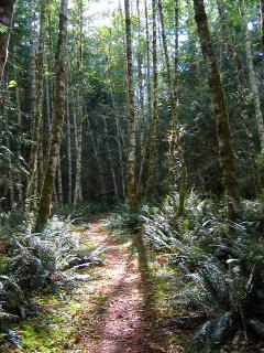 We finally saw another eagle! After spotting only two eagles at Rebecca Spit since we arrived in Canada August 4th, we've often asked ourselves, "Where are all the eagles?" Are there just too many people, too many boats, too much pressure on the environment? Wildlife seems sparse to us, the forest and skies silent. We did see a small flock of Bonaparte gulls here and two red-breasted sapsuckers while hiking.
At nine a.m. before breakfast, we left for Hole-in-the-Wall, a passage with a rapids at the end. We needed to arrive at slack water and had decided at the last minute to leave... we hadn't even eaten breakfast! So we turned up the throttle and zoomed north at seven-plus knots. There was a lot of debris to dodge as the tide had been extremely high and, when that happens, a lot of stuff gets lifted off the shoreline and carried into the channels. Another gorgeous scene, a silvery reminder of the rain overnight, made my photo look like black and white!
We finally saw another eagle! After spotting only two eagles at Rebecca Spit since we arrived in Canada August 4th, we've often asked ourselves, "Where are all the eagles?" Are there just too many people, too many boats, too much pressure on the environment? Wildlife seems sparse to us, the forest and skies silent. We did see a small flock of Bonaparte gulls here and two red-breasted sapsuckers while hiking.
At nine a.m. before breakfast, we left for Hole-in-the-Wall, a passage with a rapids at the end. We needed to arrive at slack water and had decided at the last minute to leave... we hadn't even eaten breakfast! So we turned up the throttle and zoomed north at seven-plus knots. There was a lot of debris to dodge as the tide had been extremely high and, when that happens, a lot of stuff gets lifted off the shoreline and carried into the channels. Another gorgeous scene, a silvery reminder of the rain overnight, made my photo look like black and white!
 Our arrival at the rapids was either a couple of minutes too early or a couple too late. We steered through the mild, though unnerving, whirls and upwellings, crossing the channel to enter the Octopus Islands Marine Park at low tide. This can be a good thing because at least you can see where the rocks are! The channel is very narrow and we went dead slow. Two boats were already shore-tied and we did likewise across the cove.
Octopus Islands are a cluster, a very small cluster, of rocky islets with lots more rocks and hard things to hit if you're not careful. We've been told that it's very crowded in summer so we were glad to be there in September! Only one other boat, a small houseboat on the last night, came into "our" cove the five nights we were there. We hiked (more about that later), worked on our blog, met the cruisers on the other two boats and explored in Darzee. It rained the first night and dawn came shrouded in fog, otherwise sun bathed Rikki-tikki.
Our arrival at the rapids was either a couple of minutes too early or a couple too late. We steered through the mild, though unnerving, whirls and upwellings, crossing the channel to enter the Octopus Islands Marine Park at low tide. This can be a good thing because at least you can see where the rocks are! The channel is very narrow and we went dead slow. Two boats were already shore-tied and we did likewise across the cove.
Octopus Islands are a cluster, a very small cluster, of rocky islets with lots more rocks and hard things to hit if you're not careful. We've been told that it's very crowded in summer so we were glad to be there in September! Only one other boat, a small houseboat on the last night, came into "our" cove the five nights we were there. We hiked (more about that later), worked on our blog, met the cruisers on the other two boats and explored in Darzee. It rained the first night and dawn came shrouded in fog, otherwise sun bathed Rikki-tikki.
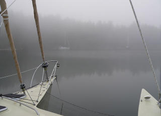 Pat and Barry, who'd sailed their boat over from Hilo, Hawaii, told us that we had to go see a little cabin on the neighboring private island. We motored over in Darzee. It was chock-full with cruiser memorabilia! We spend an hour or so looking at mementos created and left by crews of boats. Some were very elaborate and large, others just a pencilled poem or decorated clamshell. It appeared to be a tradition for some to leave a new one or add to an existing artifact with each annual visit. We had to make and leave one from Rikki-tikki-tavi!
 We selected a piece of driftwood from the shore in front of the cabin, took it back to RTT, and carved our contribution to the fantastic clutter. There is room for us to add the year of each future visit. We tied our creation to a beam above one of the windows.
 John and Lynda told us we should hike the trail to Newton Lake above Waiat Bay. They'd been for a swim four times since arriving. They told us to take the trail to the left and that it was the easier trail, forty-five minutes. They also said that there were wolves in the area (I knew I'd heard howling the previous night!). We motored over (it took ten minutes to get there at top speed!), tied Darzee up to the shore on a lowering tide, giving him a very long tether and pushing him out so he would float free and not have to be carried back to the water. With the motor, the weight would be unmanageable. A group of kayakers were arriving at the same time, but thought better of attempting the hike (did they know something we didn't?) and returned to their kayaks. So we set off into the dense forest, just the two of us. Everything was nice and fresh from the rain, ferns perky, mosses spongy and green. There was a plethora of fungi and we saw new ones we hadn't see before. We must get a book!
We took the left fork. As we went, the trail become more convoluted, detouring around downed trees and wet spots. It was obvious that someone maintains the trail as there were ribbon markers and freshly cut stumps, so it was not difficult to follow. In places, a deeply worn path cut through mosses three feet thick, dense sword ferns, cedar trees of some size but not old-growth. There were huge stumps with notches cut into them– evidence of logging long ago. We hiked for an hour. Clark started to question that we'd taken the right trail, but we'd seen no other and this one was clearly marked. So on we went. When the path turned uphill to become steep switchbacks, Clark was sure we'd done something wrong, but we kept climbing, very slowly. The path got narrower, suitable for mountain goats only– one edge went nearly straight down the mountain, the other side was steep enough to use as a handhold. I was worried about going back down!
Finally, we crossed a trickling falls and then heard a larger falls close by. We climbed some more, the path leveled out and we saw a swampy pond through the trees. No way! We hiked all this way for that? Just then, I stepped in some wolf poop. Thank goodness for the thick moss on the path sides– that is sticky stuff! This couldn't be the right lake, we decided, so we continued trudging along. We were rewarded by arriving (an hour and forty-five minutes later!) at Newton Lake– a sign confirmed it. Very large and with crystal clear water, the lake didn't seem to offer any shore with swimming access. Spotting a rock outcropping around to the left, we continued hiking there. At this point, Clark was still sure there was an easier trail than the one we'd suffered, but the path ended at the rocks. Snack time– all we brought was a little baggy of nuts!
We considered bathing but there was a chilly breeze and we hadn't brought a towel. We heard voices and I saw a couple on a rock outcrop to the right of where the trail came to the lake. It was Clark's turn to step in wolf poop on the way back. As he tried to remove the glop from his right shoe, he stepped into a whopper with his left shoe! Descending the steep trail, I stepped carefully over the ledges, rocks, tree roots, and banana slugs. I nailed one unfortunate invertebrate and almost slipped over the edge! We were soon overtaken by the two we'd seen at the lake. They bounded down the trail, with their dog in the lead, like mountain goats. John and Lynda arrived after us, got there while we were fumbling around on the wrong side of the lake, took their swim, and made it back to their dinghy way before us. Luckily they waited around on the shore for us to help carry Darzee. He'd gotten hung up in some rocks as the tide went out. All told, that hour and a half hike took us three and a half hours– and we didn't even get a swim! I saw a flotilla of surf scoters on the way back to Rikki.
On the 24th, we left Octopus Islands headed for Surge Narrows at slack water, with a final destination of Rebecca Spit. It was another sunny, beautiful day in British Columbia!
Fair winds,
Clark and Nina
John and Lynda told us we should hike the trail to Newton Lake above Waiat Bay. They'd been for a swim four times since arriving. They told us to take the trail to the left and that it was the easier trail, forty-five minutes. They also said that there were wolves in the area (I knew I'd heard howling the previous night!). We motored over (it took ten minutes to get there at top speed!), tied Darzee up to the shore on a lowering tide, giving him a very long tether and pushing him out so he would float free and not have to be carried back to the water. With the motor, the weight would be unmanageable. A group of kayakers were arriving at the same time, but thought better of attempting the hike (did they know something we didn't?) and returned to their kayaks. So we set off into the dense forest, just the two of us. Everything was nice and fresh from the rain, ferns perky, mosses spongy and green. There was a plethora of fungi and we saw new ones we hadn't see before. We must get a book!
We took the left fork. As we went, the trail become more convoluted, detouring around downed trees and wet spots. It was obvious that someone maintains the trail as there were ribbon markers and freshly cut stumps, so it was not difficult to follow. In places, a deeply worn path cut through mosses three feet thick, dense sword ferns, cedar trees of some size but not old-growth. There were huge stumps with notches cut into them– evidence of logging long ago. We hiked for an hour. Clark started to question that we'd taken the right trail, but we'd seen no other and this one was clearly marked. So on we went. When the path turned uphill to become steep switchbacks, Clark was sure we'd done something wrong, but we kept climbing, very slowly. The path got narrower, suitable for mountain goats only– one edge went nearly straight down the mountain, the other side was steep enough to use as a handhold. I was worried about going back down!
Finally, we crossed a trickling falls and then heard a larger falls close by. We climbed some more, the path leveled out and we saw a swampy pond through the trees. No way! We hiked all this way for that? Just then, I stepped in some wolf poop. Thank goodness for the thick moss on the path sides– that is sticky stuff! This couldn't be the right lake, we decided, so we continued trudging along. We were rewarded by arriving (an hour and forty-five minutes later!) at Newton Lake– a sign confirmed it. Very large and with crystal clear water, the lake didn't seem to offer any shore with swimming access. Spotting a rock outcropping around to the left, we continued hiking there. At this point, Clark was still sure there was an easier trail than the one we'd suffered, but the path ended at the rocks. Snack time– all we brought was a little baggy of nuts!
We considered bathing but there was a chilly breeze and we hadn't brought a towel. We heard voices and I saw a couple on a rock outcrop to the right of where the trail came to the lake. It was Clark's turn to step in wolf poop on the way back. As he tried to remove the glop from his right shoe, he stepped into a whopper with his left shoe! Descending the steep trail, I stepped carefully over the ledges, rocks, tree roots, and banana slugs. I nailed one unfortunate invertebrate and almost slipped over the edge! We were soon overtaken by the two we'd seen at the lake. They bounded down the trail, with their dog in the lead, like mountain goats. John and Lynda arrived after us, got there while we were fumbling around on the wrong side of the lake, took their swim, and made it back to their dinghy way before us. Luckily they waited around on the shore for us to help carry Darzee. He'd gotten hung up in some rocks as the tide went out. All told, that hour and a half hike took us three and a half hours– and we didn't even get a swim! I saw a flotilla of surf scoters on the way back to Rikki.
On the 24th, we left Octopus Islands headed for Surge Narrows at slack water, with a final destination of Rebecca Spit. It was another sunny, beautiful day in British Columbia!
Fair winds,
Clark and Nina
 We finally saw another eagle! After spotting only two eagles at Rebecca Spit since we arrived in Canada August 4th, we've often asked ourselves, "Where are all the eagles?" Are there just too many people, too many boats, too much pressure on the environment? Wildlife seems sparse to us, the forest and skies silent. We did see a small flock of Bonaparte gulls here and two red-breasted sapsuckers while hiking.
At nine a.m. before breakfast, we left for Hole-in-the-Wall, a passage with a rapids at the end. We needed to arrive at slack water and had decided at the last minute to leave... we hadn't even eaten breakfast! So we turned up the throttle and zoomed north at seven-plus knots. There was a lot of debris to dodge as the tide had been extremely high and, when that happens, a lot of stuff gets lifted off the shoreline and carried into the channels. Another gorgeous scene, a silvery reminder of the rain overnight, made my photo look like black and white!
We finally saw another eagle! After spotting only two eagles at Rebecca Spit since we arrived in Canada August 4th, we've often asked ourselves, "Where are all the eagles?" Are there just too many people, too many boats, too much pressure on the environment? Wildlife seems sparse to us, the forest and skies silent. We did see a small flock of Bonaparte gulls here and two red-breasted sapsuckers while hiking.
At nine a.m. before breakfast, we left for Hole-in-the-Wall, a passage with a rapids at the end. We needed to arrive at slack water and had decided at the last minute to leave... we hadn't even eaten breakfast! So we turned up the throttle and zoomed north at seven-plus knots. There was a lot of debris to dodge as the tide had been extremely high and, when that happens, a lot of stuff gets lifted off the shoreline and carried into the channels. Another gorgeous scene, a silvery reminder of the rain overnight, made my photo look like black and white!
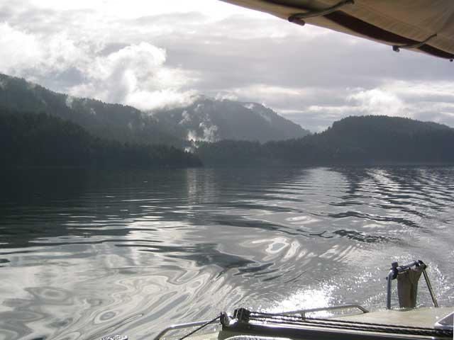 Our arrival at the rapids was either a couple of minutes too early or a couple too late. We steered through the mild, though unnerving, whirls and upwellings, crossing the channel to enter the Octopus Islands Marine Park at low tide. This can be a good thing because at least you can see where the rocks are! The channel is very narrow and we went dead slow. Two boats were already shore-tied and we did likewise across the cove.
Octopus Islands are a cluster, a very small cluster, of rocky islets with lots more rocks and hard things to hit if you're not careful. We've been told that it's very crowded in summer so we were glad to be there in September! Only one other boat, a small houseboat on the last night, came into "our" cove the five nights we were there. We hiked (more about that later), worked on our blog, met the cruisers on the other two boats and explored in Darzee. It rained the first night and dawn came shrouded in fog, otherwise sun bathed Rikki-tikki.
Our arrival at the rapids was either a couple of minutes too early or a couple too late. We steered through the mild, though unnerving, whirls and upwellings, crossing the channel to enter the Octopus Islands Marine Park at low tide. This can be a good thing because at least you can see where the rocks are! The channel is very narrow and we went dead slow. Two boats were already shore-tied and we did likewise across the cove.
Octopus Islands are a cluster, a very small cluster, of rocky islets with lots more rocks and hard things to hit if you're not careful. We've been told that it's very crowded in summer so we were glad to be there in September! Only one other boat, a small houseboat on the last night, came into "our" cove the five nights we were there. We hiked (more about that later), worked on our blog, met the cruisers on the other two boats and explored in Darzee. It rained the first night and dawn came shrouded in fog, otherwise sun bathed Rikki-tikki.
 Pat and Barry, who'd sailed their boat over from Hilo, Hawaii, told us that we had to go see a little cabin on the neighboring private island. We motored over in Darzee. It was chock-full with cruiser memorabilia! We spend an hour or so looking at mementos created and left by crews of boats. Some were very elaborate and large, others just a pencilled poem or decorated clamshell. It appeared to be a tradition for some to leave a new one or add to an existing artifact with each annual visit. We had to make and leave one from Rikki-tikki-tavi!
 We selected a piece of driftwood from the shore in front of the cabin, took it back to RTT, and carved our contribution to the fantastic clutter. There is room for us to add the year of each future visit. We tied our creation to a beam above one of the windows.
 John and Lynda told us we should hike the trail to Newton Lake above Waiat Bay. They'd been for a swim four times since arriving. They told us to take the trail to the left and that it was the easier trail, forty-five minutes. They also said that there were wolves in the area (I knew I'd heard howling the previous night!). We motored over (it took ten minutes to get there at top speed!), tied Darzee up to the shore on a lowering tide, giving him a very long tether and pushing him out so he would float free and not have to be carried back to the water. With the motor, the weight would be unmanageable. A group of kayakers were arriving at the same time, but thought better of attempting the hike (did they know something we didn't?) and returned to their kayaks. So we set off into the dense forest, just the two of us. Everything was nice and fresh from the rain, ferns perky, mosses spongy and green. There was a plethora of fungi and we saw new ones we hadn't see before. We must get a book!
We took the left fork. As we went, the trail become more convoluted, detouring around downed trees and wet spots. It was obvious that someone maintains the trail as there were ribbon markers and freshly cut stumps, so it was not difficult to follow. In places, a deeply worn path cut through mosses three feet thick, dense sword ferns, cedar trees of some size but not old-growth. There were huge stumps with notches cut into them– evidence of logging long ago. We hiked for an hour. Clark started to question that we'd taken the right trail, but we'd seen no other and this one was clearly marked. So on we went. When the path turned uphill to become steep switchbacks, Clark was sure we'd done something wrong, but we kept climbing, very slowly. The path got narrower, suitable for mountain goats only– one edge went nearly straight down the mountain, the other side was steep enough to use as a handhold. I was worried about going back down!
Finally, we crossed a trickling falls and then heard a larger falls close by. We climbed some more, the path leveled out and we saw a swampy pond through the trees. No way! We hiked all this way for that? Just then, I stepped in some wolf poop. Thank goodness for the thick moss on the path sides– that is sticky stuff! This couldn't be the right lake, we decided, so we continued trudging along. We were rewarded by arriving (an hour and forty-five minutes later!) at Newton Lake– a sign confirmed it. Very large and with crystal clear water, the lake didn't seem to offer any shore with swimming access. Spotting a rock outcropping around to the left, we continued hiking there. At this point, Clark was still sure there was an easier trail than the one we'd suffered, but the path ended at the rocks. Snack time– all we brought was a little baggy of nuts!
We considered bathing but there was a chilly breeze and we hadn't brought a towel. We heard voices and I saw a couple on a rock outcrop to the right of where the trail came to the lake. It was Clark's turn to step in wolf poop on the way back. As he tried to remove the glop from his right shoe, he stepped into a whopper with his left shoe! Descending the steep trail, I stepped carefully over the ledges, rocks, tree roots, and banana slugs. I nailed one unfortunate invertebrate and almost slipped over the edge! We were soon overtaken by the two we'd seen at the lake. They bounded down the trail, with their dog in the lead, like mountain goats. John and Lynda arrived after us, got there while we were fumbling around on the wrong side of the lake, took their swim, and made it back to their dinghy way before us. Luckily they waited around on the shore for us to help carry Darzee. He'd gotten hung up in some rocks as the tide went out. All told, that hour and a half hike took us three and a half hours– and we didn't even get a swim! I saw a flotilla of surf scoters on the way back to Rikki.
On the 24th, we left Octopus Islands headed for Surge Narrows at slack water, with a final destination of Rebecca Spit. It was another sunny, beautiful day in British Columbia!
Fair winds,
Clark and Nina
John and Lynda told us we should hike the trail to Newton Lake above Waiat Bay. They'd been for a swim four times since arriving. They told us to take the trail to the left and that it was the easier trail, forty-five minutes. They also said that there were wolves in the area (I knew I'd heard howling the previous night!). We motored over (it took ten minutes to get there at top speed!), tied Darzee up to the shore on a lowering tide, giving him a very long tether and pushing him out so he would float free and not have to be carried back to the water. With the motor, the weight would be unmanageable. A group of kayakers were arriving at the same time, but thought better of attempting the hike (did they know something we didn't?) and returned to their kayaks. So we set off into the dense forest, just the two of us. Everything was nice and fresh from the rain, ferns perky, mosses spongy and green. There was a plethora of fungi and we saw new ones we hadn't see before. We must get a book!
We took the left fork. As we went, the trail become more convoluted, detouring around downed trees and wet spots. It was obvious that someone maintains the trail as there were ribbon markers and freshly cut stumps, so it was not difficult to follow. In places, a deeply worn path cut through mosses three feet thick, dense sword ferns, cedar trees of some size but not old-growth. There were huge stumps with notches cut into them– evidence of logging long ago. We hiked for an hour. Clark started to question that we'd taken the right trail, but we'd seen no other and this one was clearly marked. So on we went. When the path turned uphill to become steep switchbacks, Clark was sure we'd done something wrong, but we kept climbing, very slowly. The path got narrower, suitable for mountain goats only– one edge went nearly straight down the mountain, the other side was steep enough to use as a handhold. I was worried about going back down!
Finally, we crossed a trickling falls and then heard a larger falls close by. We climbed some more, the path leveled out and we saw a swampy pond through the trees. No way! We hiked all this way for that? Just then, I stepped in some wolf poop. Thank goodness for the thick moss on the path sides– that is sticky stuff! This couldn't be the right lake, we decided, so we continued trudging along. We were rewarded by arriving (an hour and forty-five minutes later!) at Newton Lake– a sign confirmed it. Very large and with crystal clear water, the lake didn't seem to offer any shore with swimming access. Spotting a rock outcropping around to the left, we continued hiking there. At this point, Clark was still sure there was an easier trail than the one we'd suffered, but the path ended at the rocks. Snack time– all we brought was a little baggy of nuts!
We considered bathing but there was a chilly breeze and we hadn't brought a towel. We heard voices and I saw a couple on a rock outcrop to the right of where the trail came to the lake. It was Clark's turn to step in wolf poop on the way back. As he tried to remove the glop from his right shoe, he stepped into a whopper with his left shoe! Descending the steep trail, I stepped carefully over the ledges, rocks, tree roots, and banana slugs. I nailed one unfortunate invertebrate and almost slipped over the edge! We were soon overtaken by the two we'd seen at the lake. They bounded down the trail, with their dog in the lead, like mountain goats. John and Lynda arrived after us, got there while we were fumbling around on the wrong side of the lake, took their swim, and made it back to their dinghy way before us. Luckily they waited around on the shore for us to help carry Darzee. He'd gotten hung up in some rocks as the tide went out. All told, that hour and a half hike took us three and a half hours– and we didn't even get a swim! I saw a flotilla of surf scoters on the way back to Rikki.
On the 24th, we left Octopus Islands headed for Surge Narrows at slack water, with a final destination of Rebecca Spit. It was another sunny, beautiful day in British Columbia!
Fair winds,
Clark and Nina
Grace & Squirrel
Volume VII: Grace and Squirrel
Sounds like "Moose and Squirrel", from Rocky and Bullwinkel, my favorite cartoon series. My birthday the same day as Bullwinkel's!
Anyway, from where we left off... Grace Harbor wasn't too crowded but we did our "head for the head" routine. Our theory is other boats won't anchor in the shallow areas and we'll have more privacy. Sometimes works, sometimes not. The second day, it wasn't working.
We rowed into the area where the guide book says the stream flowing into the bay creates warm pools, where you'll be able to splash as you enjoy the rain forest. Hmmm. All we discovered were old rusty tractor parts, a big tire, muck and uninviting ooze. Maybe we had the wrong stream? We saw some folks had gone ashore from their dinghies a short distance away, so we headed there. We found a campsite, a pit toilet and a trail leading to the squishy mud trail that the "stream" piddled across. We're doing something wrong.
The next day, we decided we just hadn't walked far enough, so we trekked past the mucky part and down a long trail through the forest. It dwindled as more and more fallen trees blocked the way. Clark found himself interested in capturing the growth of mushrooms and fungi on his video camera. He did find a wide variety to keep him busy!
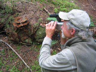 I continued to search for a trail to the "swimming lake", having spotted water through the trees (there is a lake on the chart too). Finally, I was at the edge of a wetland filled with grasses and lily pads. Could this be the right lake? It was pretty though, and Clark amused himself by taking movies of moss and spiders in their perfectly formed webs.
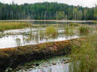 We started back and heard people calling to each other. The couple we met were gathering chantrelles! Here we were just taking photos of mushrooms, they were collecting dinner. The man, named Wolf, told us where to look for these delicate edibles and we were off– bushwacking uphill off-trail in search of the elusive 'rooms. Two hours later, I'd found one, which Wolf later pronounced as "old", but we ate it anyway in an omelette next morning.
Some new sea animals were revealed on a "really-low-tide" morning foray around the bay in Darzee. We were unsure what they were. They looked like anemones but had highly branched arms and five-segmented bodies. They were purple or orange, pink or wine-colored. Then we spotted some smaller white ones with more feathery arms. None of them were above the lowest tide mark but I managed to touch one just under the surface. It pulled in its arms and then we thought they might be nudibranchs. Research back on the boat proved the colored ones to be red sea cucumbers. The smaller white ones were stiff-footed sea cucumbers. They live in the sub-tidal zone and wedge their bodies between rocks. The shore around Grace Harbor is a good habitat for them; lots of little rocks and boulders.
The water is usually very calm in the morning and, if you are lucky to get out before the first motorized dinghy takes a dog to shore for you-know-what, the rocks, seaweeds and mosses make interesting "totems". That's what my grandparents called the reflections along the shoreline. Our family has hundreds of Kodak slides of the totems they saw in their ten years of cruising BC. I thought this one was particularly intriguing.
We started back and heard people calling to each other. The couple we met were gathering chantrelles! Here we were just taking photos of mushrooms, they were collecting dinner. The man, named Wolf, told us where to look for these delicate edibles and we were off– bushwacking uphill off-trail in search of the elusive 'rooms. Two hours later, I'd found one, which Wolf later pronounced as "old", but we ate it anyway in an omelette next morning.
Some new sea animals were revealed on a "really-low-tide" morning foray around the bay in Darzee. We were unsure what they were. They looked like anemones but had highly branched arms and five-segmented bodies. They were purple or orange, pink or wine-colored. Then we spotted some smaller white ones with more feathery arms. None of them were above the lowest tide mark but I managed to touch one just under the surface. It pulled in its arms and then we thought they might be nudibranchs. Research back on the boat proved the colored ones to be red sea cucumbers. The smaller white ones were stiff-footed sea cucumbers. They live in the sub-tidal zone and wedge their bodies between rocks. The shore around Grace Harbor is a good habitat for them; lots of little rocks and boulders.
The water is usually very calm in the morning and, if you are lucky to get out before the first motorized dinghy takes a dog to shore for you-know-what, the rocks, seaweeds and mosses make interesting "totems". That's what my grandparents called the reflections along the shoreline. Our family has hundreds of Kodak slides of the totems they saw in their ten years of cruising BC. I thought this one was particularly intriguing.
 Wolf and Jan on Theresa II hailed us as we rowed by and invited us aboard. They spent a couple of hours telling us all about their "secret" places. They've been "out" for six years (New Zealand, Fiji, etc) and have returned home to Comox, to continue their already-decades of experience boating in BC. Cruisers are so generous! Later, we rowed over a shore-tie and let out more rode to back away from a powerboat who anchored too close.
At our afternoon coffee time, we reconsidered our decision to head south, back to the Gulf Islands. We had plenty of time to keep exploring, did we not? What was the rush? We'd only been here a couple of weeks! So Rikki-tikki turned north and made tracks again for Squirrel Cove, Cortes Island. We needed a few provisions if were to stay longer. The tide was running a bit in Malaspina Inlet on our way out and we had a bit of fun negotiating the whirlpools and upwellings. A south wind was rising as we entered Squirrel Cove. We chose a spot far away from the cluster of boats anchored in front of the lagoon. We looked for protected, smooth water behind an islet, thinking, "surely nobody would be anchoring too close to us here!"
It wasn't two hours before four, count 'em four, identical SunSail charter sailboats, each with five aboard, assembled in close proximity behind us. The first boat's bow man dropped the anchor and chain straight down, where it hit bottom and stopped paying out. The guy in the cockpit was standing with his hands in his pockets, gazing rather confusedly at the steering pedestal. The ladies disappeared below. The guy up front looked down at the spot where he'd dropped the anchor, straightened up, then threw his hands in the air and walked back to the stern. We were glad we were upwind, but what if the wind switched around... we'd be a sitting mongoose! (Later, at the town store, I asked the man who'd been on the bow where their fleet was headed next. Little did he realize, I just wanted to make sure we didn't go where they were going.)
Rikki-tikki and crew found enough to keep things interesting for three nights. We took the trail. The sign read, "2.51 km", but didn't indicate to where. It was a lot of uphill through dense forest, lots of ferns and cedar, no chantrelles (Clark is now on continuous alert). Soon, the sun was on the verge of setting, so back down we went, not having arrived anywhere other than where we started. The tide was very high and that was when we met Jim. He was in his dinghy at the trailhead sign (told you the tide was very high!) asking where and how far? We couldn't give him that info, but did suggest waiting until high slack water to explore the lagoon. He roared back to his boat to pick up his wife, Sharon, and we all went over to the lagoon and shut off our motors. The end of the flood carried us in but it was too dark and the tide was too high, so we couldn't see any of the grand creatures we'd seen a couple weeks before. Just as we reached the other side, the tide turned and carried both dinghies back out into the bay! A short visit, but we met new friends.
Wolf and Jan on Theresa II hailed us as we rowed by and invited us aboard. They spent a couple of hours telling us all about their "secret" places. They've been "out" for six years (New Zealand, Fiji, etc) and have returned home to Comox, to continue their already-decades of experience boating in BC. Cruisers are so generous! Later, we rowed over a shore-tie and let out more rode to back away from a powerboat who anchored too close.
At our afternoon coffee time, we reconsidered our decision to head south, back to the Gulf Islands. We had plenty of time to keep exploring, did we not? What was the rush? We'd only been here a couple of weeks! So Rikki-tikki turned north and made tracks again for Squirrel Cove, Cortes Island. We needed a few provisions if were to stay longer. The tide was running a bit in Malaspina Inlet on our way out and we had a bit of fun negotiating the whirlpools and upwellings. A south wind was rising as we entered Squirrel Cove. We chose a spot far away from the cluster of boats anchored in front of the lagoon. We looked for protected, smooth water behind an islet, thinking, "surely nobody would be anchoring too close to us here!"
It wasn't two hours before four, count 'em four, identical SunSail charter sailboats, each with five aboard, assembled in close proximity behind us. The first boat's bow man dropped the anchor and chain straight down, where it hit bottom and stopped paying out. The guy in the cockpit was standing with his hands in his pockets, gazing rather confusedly at the steering pedestal. The ladies disappeared below. The guy up front looked down at the spot where he'd dropped the anchor, straightened up, then threw his hands in the air and walked back to the stern. We were glad we were upwind, but what if the wind switched around... we'd be a sitting mongoose! (Later, at the town store, I asked the man who'd been on the bow where their fleet was headed next. Little did he realize, I just wanted to make sure we didn't go where they were going.)
Rikki-tikki and crew found enough to keep things interesting for three nights. We took the trail. The sign read, "2.51 km", but didn't indicate to where. It was a lot of uphill through dense forest, lots of ferns and cedar, no chantrelles (Clark is now on continuous alert). Soon, the sun was on the verge of setting, so back down we went, not having arrived anywhere other than where we started. The tide was very high and that was when we met Jim. He was in his dinghy at the trailhead sign (told you the tide was very high!) asking where and how far? We couldn't give him that info, but did suggest waiting until high slack water to explore the lagoon. He roared back to his boat to pick up his wife, Sharon, and we all went over to the lagoon and shut off our motors. The end of the flood carried us in but it was too dark and the tide was too high, so we couldn't see any of the grand creatures we'd seen a couple weeks before. Just as we reached the other side, the tide turned and carried both dinghies back out into the bay! A short visit, but we met new friends.
 This is what happens when a boat is not moving very fast! Spiders set up housekeeping. Jim and Sharon took off early for Teakerne Arm the next morning for a swim at famous Cassel Lake. Coincidentally, we'd also planned to go there that day. We took Rikki-tikki to the public dock for another stop at the Squirrel Cove store on the way out. They had the right size fuel filters for RTT's oil change. A few phone calls to family and we were on our way to Teakerne Arm.
Calm waters,
Clark and Nina
This is what happens when a boat is not moving very fast! Spiders set up housekeeping. Jim and Sharon took off early for Teakerne Arm the next morning for a swim at famous Cassel Lake. Coincidentally, we'd also planned to go there that day. We took Rikki-tikki to the public dock for another stop at the Squirrel Cove store on the way out. They had the right size fuel filters for RTT's oil change. A few phone calls to family and we were on our way to Teakerne Arm.
Calm waters,
Clark and Nina
Subscribe to:
Posts (Atom)